- Alternative title
-
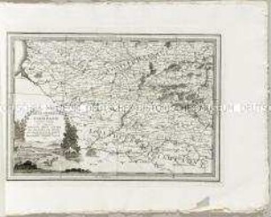
CHARTA PLANA / DE LA PROVINCIA DE / LA HACHA; / SITUADA ENTRE LAS DE SANTA MARTA
- Location
-
Deutsches Historisches Museum, Berlin
- Inventory number
-
Do 2006/1164
- Measurements
-
Höhe x Breite: 47 x 61 cm (Blatt)
Höhe x Breite: 34,4 x 37,3 cm (Karte)
Höhe x Breite: 39,3 x 42,3 cm (Platte)
- Material/Technique
-
Papier, Kupferstich, koloriert
- Classification
-
Kartografie (Gattung)
- Subject (what)
-
Kolumbien
Venezuela
Südamerika
- Event
-
Herstellung
- (who)
-
Geograph, Kartograf: Juan Lopez
- (where)
-
Madrid, Spanien
- (when)
-
1786
- Rights
-
Deutsches Historisches Museum
- Last update
-
24.03.2023, 9:29 AM CET
Data provider
This object is provided by:
Stiftung Deutsches Historisches Museum. If you have any questions about the object, please contact the data provider.
Stiftung Deutsches Historisches Museum. If you have any questions about the object, please contact the data provider.
Object type
- Regionalkarte
Associated
- Geograph, Kartograf: Juan Lopez
Time of origin
- 1786
Other Objects (12)
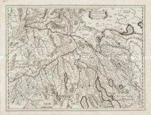
Zurichgow et Basiliensis provincia
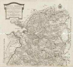
Provincia Arlbergica. Mit einer Ansicht
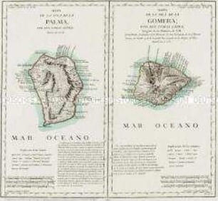
Mapa de la Isla de la Palma / Mapa de la Isla de la Gomera
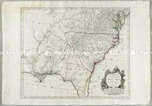
Partie Méridionale de la Louisiane, avec de la Floride, la Caroline et la Virginie
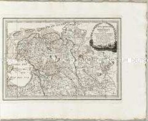
Nuovo Atlante Geografico Universale: Carta Generale de'Paesi Bassi Secondo Foglio
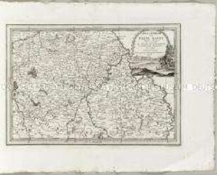
Nuovo Atlante Geografico Universale: Carta Generale de'Paesi Bassi Sesto Foglio
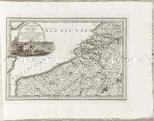
Nuovo Atlante Geografico Universale: Carta Generale de'Paesi Bassi Terzo Foglio
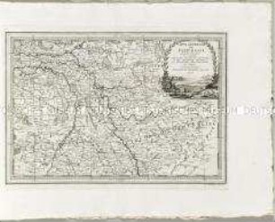
Nuovo Atlante Geografico Universale: Carta Generale de'Paesi Bassi Quarto Foglio
Nuovo Atlante Geografico Universale: Carta Generale de'Paesi Bassi Quinto Foglio
Nuovo Atlante Geografico Universale: Carta Generale de'Paesi Bassi Primo Foglio
Nuovo Atlante Geografico Universale: La Biscaglia La Castilia Vecchia e La Navarra
La Lorraine
Zurichgow et Basiliensis provincia
Provincia Arlbergica. Mit einer Ansicht
Mapa de la Isla de la Palma / Mapa de la Isla de la Gomera
Partie Méridionale de la Louisiane, avec de la Floride, la Caroline et la Virginie
Nuovo Atlante Geografico Universale: Carta Generale de'Paesi Bassi Secondo Foglio
Nuovo Atlante Geografico Universale: Carta Generale de'Paesi Bassi Sesto Foglio
Nuovo Atlante Geografico Universale: Carta Generale de'Paesi Bassi Terzo Foglio
Nuovo Atlante Geografico Universale: Carta Generale de'Paesi Bassi Quarto Foglio
Nuovo Atlante Geografico Universale: Carta Generale de'Paesi Bassi Quinto Foglio
Nuovo Atlante Geografico Universale: Carta Generale de'Paesi Bassi Primo Foglio
Nuovo Atlante Geografico Universale: La Biscaglia La Castilia Vecchia e La Navarra