- Location
-
Leibniz-Institut für Länderkunde e.V., Leipzig
- Other number(s)
-
HK 0138 (Signatur)
- Material/Technique
-
unkolor.
- Inscription/Labeling
-
Maßstab in graph. Form (milla exuatorial). - Titel unten rechts. - Mit 2 Nebenkt.: Isla de San Andres & Isla de Providencia. - Oben links: Estados Unidos De Colombia. - Eventuell aus: Mosquera, T. C. de, Compendio de geografia general política, física y especial de los Estados Unidos de Colombia, 1886. - Relief: Gebirge in Schraffen
- Subject (what)
-
Altkarte
Kolumbien
Bolivar (Departamento)
- Event
-
Veröffentlichung
- (who)
-
Thierry hermanos [Thierry Frères] (Verlag)
- (where)
-
Paris
- (when)
-
1865
- Rights
-
Leibniz-Institut für Länderkunde e.V.
- Last update
-
15.05.2025, 12:43 PM CEST
Data provider
This object is provided by:
Leibniz-Institut für Länderkunde e. V.. If you have any questions about the object, please contact the data provider.
Leibniz-Institut für Länderkunde e. V.. If you have any questions about the object, please contact the data provider.
Object type
- Karte
Associated
- Thierry hermanos [Thierry Frères] (Verlag)
Time of origin
- 1865
Other Objects (12)

Carta Corográfica Del Estado Del Cauca

Carta Corografica Del Estado Del Tolima
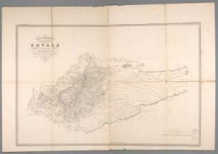
Carta Corográfica Del Estado De Boyacá
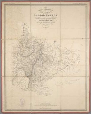
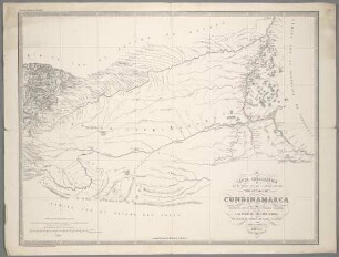
Carta Corográfica Del Estado De Cundinamarca
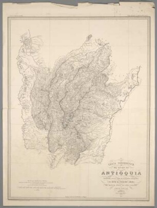
Carta Corográfica Del Estado De Antioquia
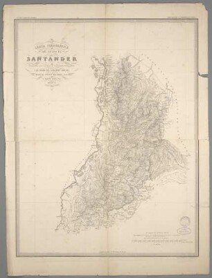
Carta Corográfica Del Estado De Santander
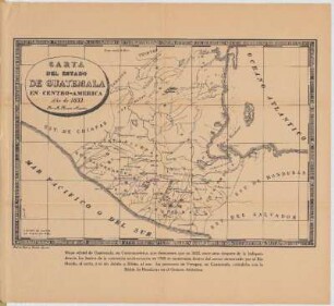
Carta Del Estado De Guatemala En Centro-America
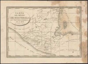
Carta Del Estado De Guatemala En Centro-America

Carta Geognostica de los principales Distritos Minerales del Estado De Mexico
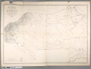
Carta Corográfica de la parte oriental i ménos poblada Del Estado Del Cauca
Carta Corográfica de la parte oriental i ménos poblada Del Estado De Cundinamarca
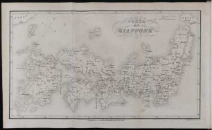
Carta del Giappone
Carta Corográfica Del Estado Del Cauca
Carta Corografica Del Estado Del Tolima
Carta Corográfica Del Estado De Boyacá
Carta Corográfica Del Estado De Cundinamarca
Carta Corográfica Del Estado De Antioquia
Carta Corográfica Del Estado De Santander
Carta Del Estado De Guatemala En Centro-America
Carta Del Estado De Guatemala En Centro-America
Carta Geognostica de los principales Distritos Minerales del Estado De Mexico
Carta Corográfica de la parte oriental i ménos poblada Del Estado Del Cauca
Carta Corográfica de la parte oriental i ménos poblada Del Estado De Cundinamarca