- Location
-
München, Bayerische Staatsbibliothek -- Mapp. VIII,210 ft
- Dimensions
-
79 x 64 cm, gefaltet
- Extent
-
1 Kt.
- Edition
-
79. Aufl.
- Language
-
Deutsch
- Notes
-
mehrfarb.
Mit 1 Nebenkt.: Rheinisch-Westfälisches Industriegebiet
- Bibliographic citation
-
Flemmings Generalkarten ; 10gn
- Series
-
Flemmings Generalkarten; 10gn
- Keyword
- Event
-
Veröffentlichung
- (where)
-
Braunschweig u.a.
- (who)
-
Westermann
- (when)
-
[1933]
- URN
-
urn:nbn:de:bvb:12-bsb00019819-2
- Last update
-
27.11.2025, 8:41 AM CET
Data provider
This object is provided by:
Bayerische Staatsbibliothek. If you have any questions about the object, please contact the data provider.
Bayerische Staatsbibliothek. If you have any questions about the object, please contact the data provider.
Object type
- kartografisches Bild
Associated
- Westermann
Time of origin
- [1933]
Other Objects (12)

Landformen im Kartenbild, Gruppe 2,. Mittelgebirge : gefalteter Unterbau, stellenweise überlagert

Freistaat Bayern
Landformen im Kartenbild, Gruppe 2,. Mittelgebirge : gefalteter Unterbau, stellenweise überlagert
Landformen im Kartenbild, Gruppe 6,. Alpen : nördliche Flysch- und Kalkalpen
Landformen im Kartenbild, Gruppe 7,. Alpen : Zentralalpen
Landformen im Kartenbild, Gruppe 3,. Mittelgebirge : Schichttafeln, Schichtstufen, Schichtkämme
Landformen im Kartenbild, Gruppe 2,. Mittelgebirge : gefalteter Unterbau, stellenweise überlagert
Landformen im Kartenbild, Gruppe 1,. Norddeutsches Flachland
Landformen im Kartenbild, Gruppe 3,. Mittelgebirge : Schichttafeln, Schichtstufen, Schichtkämme
Weltatlas Erdöl und Erdgas
Petro-Atlas Erdöl und Erdgas
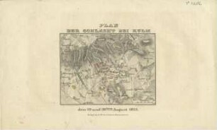
Plan der Schlacht bei Kulm : den 29 und 30ten August 1813
Landformen im Kartenbild, Gruppe 2,. Mittelgebirge : gefalteter Unterbau, stellenweise überlagert
Freistaat Bayern
Landformen im Kartenbild, Gruppe 2,. Mittelgebirge : gefalteter Unterbau, stellenweise überlagert
Landformen im Kartenbild, Gruppe 6,. Alpen : nördliche Flysch- und Kalkalpen
Landformen im Kartenbild, Gruppe 7,. Alpen : Zentralalpen
Landformen im Kartenbild, Gruppe 3,. Mittelgebirge : Schichttafeln, Schichtstufen, Schichtkämme
Landformen im Kartenbild, Gruppe 2,. Mittelgebirge : gefalteter Unterbau, stellenweise überlagert
Landformen im Kartenbild, Gruppe 1,. Norddeutsches Flachland
Landformen im Kartenbild, Gruppe 3,. Mittelgebirge : Schichttafeln, Schichtstufen, Schichtkämme
Weltatlas Erdöl und Erdgas
Petro-Atlas Erdöl und Erdgas