Freifläche | Grünfläche
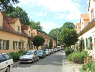
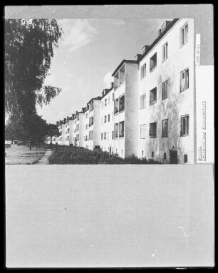
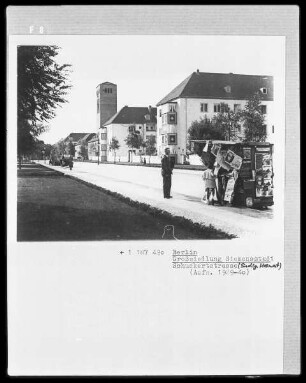
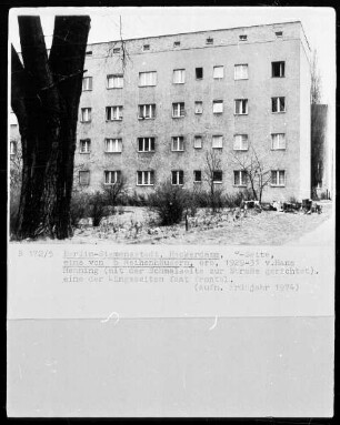
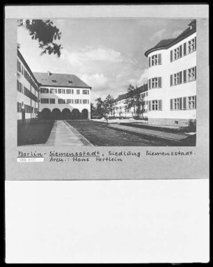
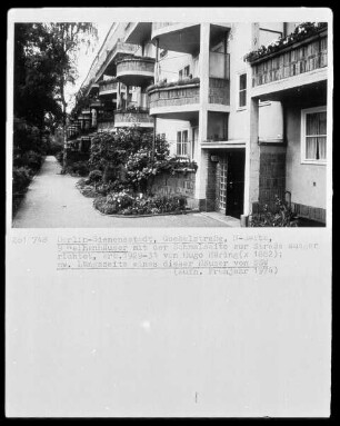
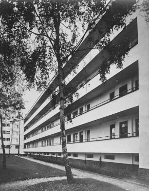
Öffentliche Frei- und Grünflächen der Siedlung Siemensstadt; Berlin, Spandau
- Location
-
Rohrdamm 35 & 36 & 37 & 38 & 39 & 40 & 41 & 42 & 43 & 44 & 45 & 46 & 47 & 48 & 49 & 50 & 51 & 52 & 53 & 54 / Dihlmannstraße 10 & 12 & 14 & 16 & 18 & 20 & 30 / Harriesstraße 1 & 2 & 3 & 4 & 5 & 6 & 7 & 8 & 9 & 10 & 11 & 12 & 13 & 14 & 16 / Rapsstraße 2 & 3 & 4 & 5 & 6 & 7 & 8 & 9 & 10 & 11 & 12 & 13 & 14 & 15 & 16 & 17 & 18 & 19 & 20 & 21 & 22 & 23 & 24 & 25 & 26 & 27 & 28 & 29 & 30 & 31 & 32 & 33 & 34 & 35 & 37 & 38 & 39 & 40 & 41 & 42 & 43 & 44 & 45 & 46 & 47 & 48 & 49 & 50 & 51 & 52 & 53 & 54 & 55 & 56 & 57 & 58 & 59 & 61 & 62 & 63 & 64 & 65 & 66 & 67 & 68 & 69 & 70 & 71 & 72 & 73 & 74 / Rieppelstraße 1 & 2 & 3 & 4 & 5 & 6 & 7 & 8 & 9 & 10 & 11 & 12 & 13 & 14 & 15 & 16 & 17 & 18 & 19 & 20 & 21 & 22 & 23 & 24 & 25 & 26 & 28 / Im Eichengrund, Siemensstadt, Spandau, Berlin
- Related object and literature
- Classification
-
Gartendenkmal
- Event
-
Herstellung
- (when)
-
1921-1930
- Last update
-
04.06.2025, 11:55 AM CEST
Data provider
This object is provided by:
Landesdenkmalamt Berlin. If you have any questions about the object, please contact the data provider.
Landesdenkmalamt Berlin. If you have any questions about the object, please contact the data provider.
Object type
- Freifläche; Grünfläche
Time of origin
- 1921-1930
Other Objects (12)
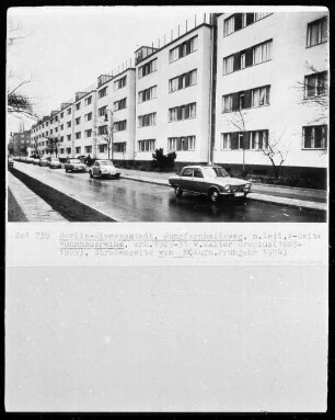
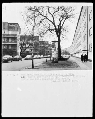
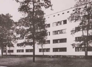
Siedlung Siemensstadt & Siemens-Arbeitersiedlung; Berlin, Spandau
Siedlung Siemensstadt

Siedlung Siemensstadt
Siedlung Siemensstadt
Siedlung Siemensstadt
Siedlung Siemensstadt
Siedlung Siemensstadt

Siedlung Siemensstadt
Siedlung Siemensstadt
Siedlung Siemensstadt
Siedlung Siemensstadt
Siedlung Siemensstadt
Siedlung Siemensstadt & Siemens-Arbeitersiedlung; Berlin, Spandau
Siedlung Siemensstadt
Siedlung Siemensstadt
Siedlung Siemensstadt
Siedlung Siemensstadt
Siedlung Siemensstadt
Siedlung Siemensstadt
Siedlung Siemensstadt
Siedlung Siemensstadt
Siedlung Siemensstadt
Siedlung Siemensstadt
Siedlung Siemensstadt
Siedlung Siemensstadt & Siemens-Arbeitersiedlung; Berlin, Spandau
Siedlung Siemensstadt
Siedlung Siemensstadt
Siedlung Siemensstadt
Siedlung Siemensstadt
Siedlung Siemensstadt
Siedlung Siemensstadt
Siedlung Siemensstadt
Siedlung Siemensstadt
Siedlung Siemensstadt
Siedlung Siemensstadt