Karten und Pläne
"Recentissima totius Galliae seu Franciae tabula, [...] Impensis Homannianorum hered, 1791 cum Privil. S.C.M."
Enthält u. a.: Umrahmung unten links "Res nouvelle Carte De La France divisee en toutes ses Departements".
- Reference number
-
Sächsisches Staatsarchiv, 12884 Karten, Risse, Bilder, Nr. Schr 000, F 160, Nr 022 (Zu benutzen im Hauptstaatsarchiv Dresden)
- Further information
-
Personen/Institutionen: Homann, Johann Baptist, Nürnberg.
Maßstab: 20 Französische Meilen=15 Deutsche Meilen=4,7 cm
Umfang: 1
Format: 53x41,5
- Context
-
12884 Karten, Risse, Bilder >> 1. Karten >> 1.27. Frankreich
- Holding
-
12884 Karten, Risse, Bilder
- Date of creation
-
1791
- Other object pages
- Rights
-
Es gilt die Sächsische Archivbenutzungsverordnung vom 8. September 2022 (SächsGVBl. S. 526).
- Last update
-
21.03.2024, 8:17 AM CET
Data provider
This object is provided by:
Sächsisches Staatsarchiv. If you have any questions about the object, please contact the data provider.
Sächsisches Staatsarchiv. If you have any questions about the object, please contact the data provider.
Object type
- Karten und Pläne
Time of origin
- 1791
Other Objects (12)
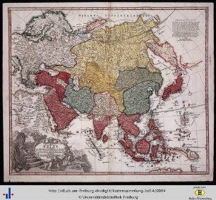
Recentissima Asiae delineatio.

Asiae Recentißima Delineatio
Recentissima Asiae Delineatio

SCM

SCM

SCM

SCM
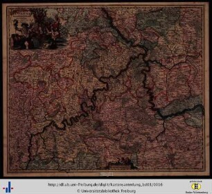
Archiepiscopatus Trevirensis Recentissima Delineatio
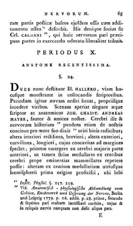
Periodus X. Anatome Recentissima.
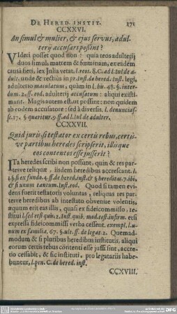
De Hered. Instit.
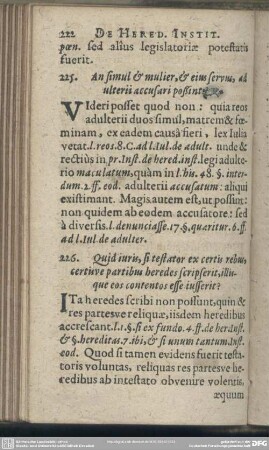
De Hered. Instit
SCM 193
Recentissima Asiae delineatio.
Asiae Recentißima Delineatio
Recentissima Asiae Delineatio
SCM
SCM
SCM
SCM
Archiepiscopatus Trevirensis Recentissima Delineatio
Periodus X. Anatome Recentissima.
De Hered. Instit.
De Hered. Instit
SCM 193
Recentissima Asiae delineatio.
Asiae Recentißima Delineatio
Recentissima Asiae Delineatio
SCM
SCM
SCM
SCM
Archiepiscopatus Trevirensis Recentissima Delineatio
Periodus X. Anatome Recentissima.
De Hered. Instit.
De Hered. Instit