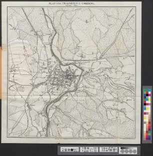
- Location
-
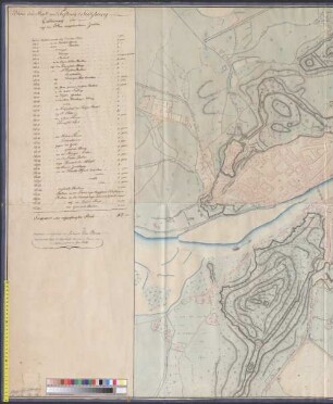
München, Bayerische Staatsbibliothek -- Mapp. XI,186 wva
- Dimensions
-
89 x 69 cm
- Extent
-
1 Kt.
- Language
-
Deutsch
- Notes
-
mehrfarb.
Mit 1 Nebenkt.: Plan der Stadt Neuburg
- Keyword
-
Geografieunterricht
Höhenschicht
Landkreis Neuburg a.d. Donau
Neuburg a.d. Donau
- URN
-
urn:nbn:de:bvb:12-bsb00140843-7
- Last update
-
16.04.2025, 8:31 AM CEST
Data provider
This object is provided by:
Bayerische Staatsbibliothek. If you have any questions about the object, please contact the data provider.
Bayerische Staatsbibliothek. If you have any questions about the object, please contact the data provider.
Object type
- Karte
- Stadtplan
Associated
Time of origin
- s.a. [ca. 1900]
Other Objects (12)
![[Neuburg, Donau]](https://iiif.deutsche-digitale-bibliothek.de/image/2/a57fca89-910d-470e-94bd-27a1d79f2392/full/!306,450/0/default.jpg)
[Neuburg, Donau]

Wandkarte von Deutschland In Seiner Neugestaltung

Atlas Stadtpläne von Rostock 1922 - 1938 - 1948 : Warnemünde 1922 und 1948 sowie der Rostocker Heide 1921 und 1951

Handbook of the River Plate Republics : comprising Buenos Ayres and the Provinces of the Argentine Republic and the Republics of Uruguay and Paraguay
Plan der Stadt und Festung Salzburg - BSB Cod.icon. 180 ukx
SALZBURG// mit seinen Umgebungen - BSB Cod.icon. 180 ukv
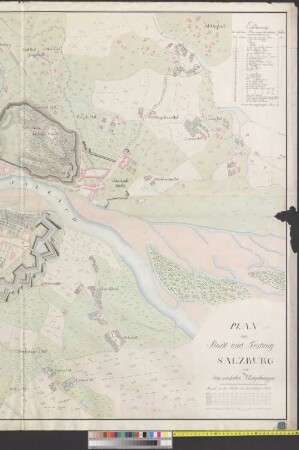
PLAN// der// Stadt und Festung// SALZBURG// mit den nächsten Umgebungen - BSB Cod.icon. 180 ula

Stadtplan Karte
Stadtplan Karte
Neuester Stadtplan von Traunstein
Amtlicher Bericht über die Epidemieen der asiatischen Cholera des Jahres 1866 in den Regierungsbezirken Unterfranken und Aschaffenburg, Schwaben und Neuburg
Amtlicher Bericht über die Epidemieen der asiatischen Cholera des Jahres 1866 in den Regierungsbezirken Unterfranken und Aschaffenburg, Schwaben und Neuburg
[Neuburg, Donau]
Wandkarte von Deutschland In Seiner Neugestaltung
Atlas Stadtpläne von Rostock 1922 - 1938 - 1948 : Warnemünde 1922 und 1948 sowie der Rostocker Heide 1921 und 1951
Handbook of the River Plate Republics : comprising Buenos Ayres and the Provinces of the Argentine Republic and the Republics of Uruguay and Paraguay
Plan der Stadt und Festung Salzburg - BSB Cod.icon. 180 ukx
SALZBURG// mit seinen Umgebungen - BSB Cod.icon. 180 ukv
PLAN// der// Stadt und Festung// SALZBURG// mit den nächsten Umgebungen - BSB Cod.icon. 180 ula
Stadtplan Karte
Stadtplan Karte
Neuester Stadtplan von Traunstein
Amtlicher Bericht über die Epidemieen der asiatischen Cholera des Jahres 1866 in den Regierungsbezirken Unterfranken und Aschaffenburg, Schwaben und Neuburg