Karte
Laurie's General Chart of the Coasts of Brasil, &c. : From The River Para to Buenos-Ayres
- Location
-
Leibniz-Institut für Länderkunde e.V., Leipzig
- Collection
-
Collection Alphons Stübel
- Other number(s)
-
HK 1548 - 01 (Signatur)
- Material/Technique
-
unkolor.
- Inscription/Labeling
-
Kt. ist in 3 Teile zerlegt, nur 2 Teile vorhanden. - Ohne Maßstab. - Titel unten rechts. - Mit Tiefenangaben. - Relief: Schraffen. - Mit 11 Nebenkt.: Harbour of Rio De Janeiro. Bahia or San Salvador. Sta. Catharina. Marambaya. Porto Maçayo. Pernambuco. Roadstead Of Cape Sta. Maria. Bahia Do Espirito Santo. Sta. Barbara. The Approaches to Pernambuco. The Cape. - Mit 4 Profilen: View of the city of Rio Janeiro, as seen from the Isle Cobras. Appearance of the City of San Salvador, or Bahia. The Land of the Entrance of Rio de Janeiro, when the Harbour appears open. The Entrance of Rio de Janeiro, when the Sugar-loaf bears N.W. 1/4 W. true, and Santa Cruz N.N.W. 3/4 W.
- Subject (what)
-
Altkarte
Seekarte
Küste
Hafen
Brasilien
- Event
-
Veröffentlichung
- (who)
-
Richd. H. Laurie (Verlag)
- (where)
-
London
- (when)
-
1873
- Rights
-
Leibniz-Institut für Länderkunde e.V.
- Last update
-
15.05.2025, 12:44 PM CEST
Data provider
This object is provided by:
Leibniz-Institut für Länderkunde e. V.. If you have any questions about the object, please contact the data provider.
Leibniz-Institut für Länderkunde e. V.. If you have any questions about the object, please contact the data provider.
Object type
- Karte
Associated
- Richd. H. Laurie (Verlag)
Time of origin
- 1873
Other Objects (12)

Laurie Anderson
Annie Laurie
Laurie Anderson

LAURIE'S ABRIDGED CATALOGUE
Performance: Laurie Anderson
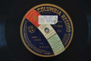
Annie Laurie / (Scott)
Laurie, Malcolm * 27.2.1866
Laurie, Mary * 09.09.1929
Laurie, Gilbert * 20.11.1836
Ayres Köpke
Buenos-Ayres
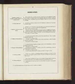
BUENOS-AYRES.
Laurie Anderson
Annie Laurie
Laurie Anderson
LAURIE'S ABRIDGED CATALOGUE
Performance: Laurie Anderson
Annie Laurie / (Scott)
Laurie, Malcolm * 27.2.1866
Laurie, Mary * 09.09.1929
Laurie, Gilbert * 20.11.1836
Ayres Köpke
Buenos-Ayres
BUENOS-AYRES.
Laurie Anderson
Annie Laurie
Laurie Anderson
LAURIE'S ABRIDGED CATALOGUE
Performance: Laurie Anderson
Annie Laurie / (Scott)
Laurie, Malcolm * 27.2.1866
Laurie, Mary * 09.09.1929
Laurie, Gilbert * 20.11.1836
Ayres Köpke
Buenos-Ayres