Karten und Pläne
Forstliche Übersichtskarte Landkreis Landsberg a. Lech, Stand: 1997
- Reference number
-
StAM, Plansammlung 8044
- Dimensions
-
72 (B) x 94cm (H)
- Formal description
-
Papier; 1:50.000
- Language of the material
-
deutsch
- Further information
-
Urheber: Zeichner: o. V.
Drucker/Verlag: Kartographische Anstalt der Ministerialforstabteilung (?)
- Context
-
Plansammlung >> Plansammlung >> 2. Plansammlung ab Nr. 4192 (nach Provenienzen) >> 2.5. Forstbehörden (Forstkarten und -pläne) >> 2.5.2. Forstbehörden nach 1803 >> 2.5.2.19. Forstamt Schongau (mit Revieren ä. O.)
- Holding
-
StAM, Plansammlung Plansammlung
- Date of creation
-
1997
- Other object pages
- Provenance
-
Forstamt n. O. Schongau
- Last update
-
22.04.2025, 1:53 PM CEST
Data provider
This object is provided by:
Staatsarchiv München. If you have any questions about the object, please contact the data provider.
Staatsarchiv München. If you have any questions about the object, please contact the data provider.
Object type
- Karten und Pläne
Time of origin
- 1997
Other Objects (12)

Landsberg a.Lech (Lkr. Landsberg a.Lech)
Landsberg / Lech

Landsberg (Lech)
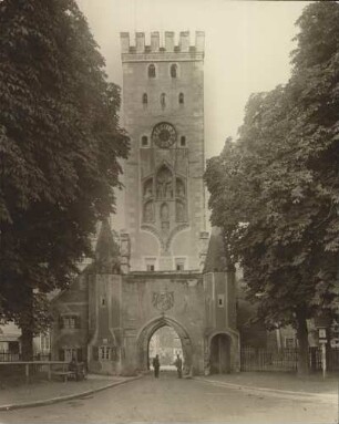
![Landsberg am Lech (Lkr. Landsberg am Lech): [Schmalzturm]](https://iiif.deutsche-digitale-bibliothek.de/image/2/fb67d42f-4926-4966-9e17-a3d0fe7a5898/full/!306,450/0/default.jpg)
Landsberg am Lech (Lkr. Landsberg am Lech): [Schmalzturm]
![Landsberg am Lech (Lkr. Landsberg am Lech): [Schmalzturm]](https://iiif.deutsche-digitale-bibliothek.de/image/2/242e01ca-b253-4f08-9207-59a862c83528/full/!306,450/0/default.jpg)
Landsberg am Lech (Lkr. Landsberg am Lech): [Schmalzturm]
Landsberg am Lech, Bayerntor : Landsberg am Lech. Bayerntor
![Landsberg am Lech (Lkr. Landsberg am Lech): [Schmalzturm]](https://iiif.deutsche-digitale-bibliothek.de/image/2/12ead098-d8e8-4ccd-9296-2e142a22af7f/full/!306,450/0/default.jpg)
Landsberg am Lech (Lkr. Landsberg am Lech): [Schmalzturm]
Landsberg am Lech - Wirtschaftsstandort : = Landsberg am Lech - business location
Industriewerke Landsberg a. Lech AG, in Landsberg a. Lech
Plansammlung Landsberg am Lech (Lkr. Landsberg am Lech) (Bestand)
Landsberg am Lech
Landsberg am Lech
Landsberg a.Lech (Lkr. Landsberg a.Lech)
Landsberg / Lech
Landsberg (Lech)
Landsberg am Lech (Lkr. Landsberg am Lech): [Schmalzturm]
Landsberg am Lech (Lkr. Landsberg am Lech): [Schmalzturm]
Landsberg am Lech, Bayerntor : Landsberg am Lech. Bayerntor
Landsberg am Lech (Lkr. Landsberg am Lech): [Schmalzturm]
Landsberg am Lech - Wirtschaftsstandort : = Landsberg am Lech - business location
Industriewerke Landsberg a. Lech AG, in Landsberg a. Lech
Plansammlung Landsberg am Lech (Lkr. Landsberg am Lech) (Bestand)
Landsberg am Lech