- Alternative title
-
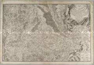
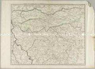
CARTE / DU TYROL / VÉRIFIÉE ET CORRIGÉE / SUR LES MÉMOIRES
- Location
-
Deutsches Historisches Museum, Berlin
- Inventory number
-
Do 2006/1051.1-6
- Measurements
-
Höhe x Breite: 63,5 x 94 cm (Blatt)
Höhe x Breite: 56 x 82,7 cm (Karte)
Höhe x Breite: 60,5 x 89,5 cm (Platte)
- Material/Technique
-
Papier, Kupferstich
- Classification
-
Kartografie (Gattung)
- Subject (what)
-
Tirol
Österreich
Italien
- Event
-
Herstellung
- (who)
-
Kartograf, Stecher: Peter Anich
Kartograf: Blasius Hueber
Stecher: Alexandre Blondeau
Stecher, Verleger: Jean-Baptiste-Marie Chamouin
- (where)
-
Paris, Frankreich
- (when)
-
um 1800
- Rights
-
Deutsches Historisches Museum
- Last update
-
24.03.2023, 9:31 AM CET
Data provider
This object is provided by:
Stiftung Deutsches Historisches Museum. If you have any questions about the object, please contact the data provider.
Stiftung Deutsches Historisches Museum. If you have any questions about the object, please contact the data provider.
Object type
- Regionalkarte
Associated
- Kartograf, Stecher: Peter Anich
- Kartograf: Blasius Hueber
- Stecher: Alexandre Blondeau
- Stecher, Verleger: Jean-Baptiste-Marie Chamouin
Time of origin
- um 1800
Other Objects (12)
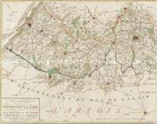
Carte du Departement du Nord
Carte Topographique du Cours du Rhin
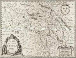
Carte du Pais de Retelois
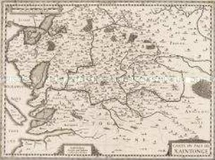
Carte du Pais de Xaintonge
Nouvelle Carte du Détroit de Gibraltar et de I'Isle de Cadix. Mit einer Nebenkarte: Plan de Gibraltar

Carte des Isles Britanniques. Mit einer Nebenkarte: Suplément pour les Isles Orcades et de Schetland
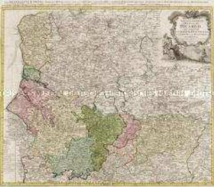
Carte du Gouvernement General De Picardie
Carte du Comté de la Marck
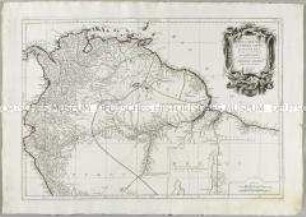
Carte du Pérou et Brésil sepl.
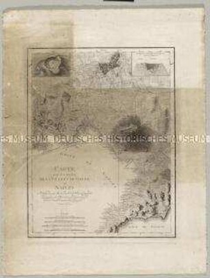
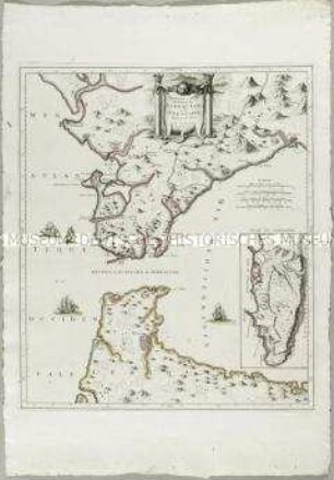
Carte des Environs de la Ville et du Golfe de Naples. Mit einer Nebenkarte: Plan du Cratere und einem Profil: Coupe du Cratere
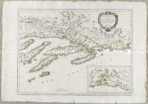
Nouvelle Carte de la Partie Orientale de Dalmatie. Mit einer Nebenkarte: Baye ou Bocche di Cattaro
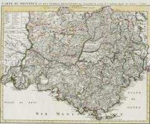
Carte de Provence
Carte du Departement du Nord
Carte Topographique du Cours du Rhin
Carte du Pais de Retelois
Carte du Pais de Xaintonge
Nouvelle Carte du Détroit de Gibraltar et de I'Isle de Cadix. Mit einer Nebenkarte: Plan de Gibraltar
Carte des Isles Britanniques. Mit einer Nebenkarte: Suplément pour les Isles Orcades et de Schetland
Carte du Gouvernement General De Picardie
Carte du Comté de la Marck
Carte du Pérou et Brésil sepl.
Carte des Environs de la Ville et du Golfe de Naples. Mit einer Nebenkarte: Plan du Cratere und einem Profil: Coupe du Cratere
Nouvelle Carte de la Partie Orientale de Dalmatie. Mit einer Nebenkarte: Baye ou Bocche di Cattaro