Bericht
Redrawing the maps in Kashmir: New geopolitical realities in the conflict between China, India, and Pakistan
The political geography of Kashmir has changed radically in recent months. The starting point was the Indian government's decision on 5 August 2019 to divide the state of Jammu and Kashmir (J&K) into two Union territories. In response, Islamabad published a map on 4 August 2020 showing all of Kashmir as part of Pakistan. At the end of September 2020, the Chinese government terminated the status quo with India in the Ladakh/Aksai Chin region. This indicates a new phase in the conflict over Kashmir, in which China and Pakistan could work more closely together. In addition, the conflict is being expanded to include a new geopolitical dimension because, for China, the dispute with India is now also part of the struggle with the United States over the future distribution of power in the Indo-Pacific.
- Sprache
-
Englisch
- Erschienen in
-
Series: SWP Comment ; No. 52/2020
- Klassifikation
-
Politik
- Ereignis
-
Geistige Schöpfung
- (wer)
-
Wagner, Christian
Stanzel, Angela
- Ereignis
-
Veröffentlichung
- (wer)
-
Stiftung Wissenschaft und Politik (SWP)
- (wo)
-
Berlin
- (wann)
-
2020
- DOI
-
doi:10.18449/2020C52
- Handle
- Letzte Aktualisierung
-
10.03.2025, 11:43 MEZ
Datenpartner
ZBW - Deutsche Zentralbibliothek für Wirtschaftswissenschaften - Leibniz-Informationszentrum Wirtschaft. Bei Fragen zum Objekt wenden Sie sich bitte an den Datenpartner.
Objekttyp
- Bericht
Beteiligte
- Wagner, Christian
- Stanzel, Angela
- Stiftung Wissenschaft und Politik (SWP)
Entstanden
- 2020
Ähnliche Objekte (12)

A "roadmap" for Kashmir?
Rethinking South Asia: Scenarios for a changing geopolitical landscape
Rethinking South Asia: scenarios for a changing geopolitical landscape
![Kapitalienbuch des Rudolf-Sophien-Stifts in Stuttgart auf die Rechnungsjahre 1944 bis [1946]](/assets/placeholder/searchResultMediaNoDigitisedMedia.png)
Kapitalienbuch des Rudolf-Sophien-Stifts in Stuttgart auf die Rechnungsjahre 1944 bis [1946]
Die Flucht der Frauen

Christian Wagner: Rechtfertigungsschreiben an Landgraf Karl, 1716

Christian Wagner: Mechanische Krafft eines neu erfundenen Poch-Werckes ...
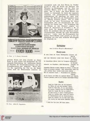
Gedichte
De originibus Saalfeldi urbis in Thuringia sitae
Großmacht im Wartestand? Indische Außenpolitik am Beginn des 21. Jahrhunderts
Experimentelle und theoretische Untersuchungen zum Ein-Atom-Maser
Wagner, Christian: Erstellung einer Scheuer
A "roadmap" for Kashmir?
Rethinking South Asia: Scenarios for a changing geopolitical landscape
Rethinking South Asia: scenarios for a changing geopolitical landscape
Kapitalienbuch des Rudolf-Sophien-Stifts in Stuttgart auf die Rechnungsjahre 1944 bis [1946]
Die Flucht der Frauen
Christian Wagner: Rechtfertigungsschreiben an Landgraf Karl, 1716
Christian Wagner: Mechanische Krafft eines neu erfundenen Poch-Werckes ...
Gedichte
De originibus Saalfeldi urbis in Thuringia sitae
Großmacht im Wartestand? Indische Außenpolitik am Beginn des 21. Jahrhunderts
Experimentelle und theoretische Untersuchungen zum Ein-Atom-Maser