Karten und Pläne
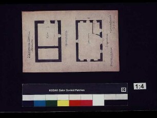
Gemarkung Abstatt: Entwässerungsprojekt der Herrnbrückenwiesen
Enthält: Situationsplan
- Archivaliensignatur
-
Landesarchiv Baden-Württemberg, Abt. Staatsarchiv Wertheim, R-K Nr. 7216
- Maße
-
26,5 x 35,5 (Höhe x Breite)
- Bemerkungen
-
aus StAWt-R Lit. B Nr. 3498 e
- Sonstige Erschließungsangaben
-
Ausführung: Federzeichnung; handkoloriert
- Kontext
-
Karten und Pläne >> G. Württemberg >> G.2. Abstatt >> G.2.1. Abstatt
- Bestand
-
Landesarchiv Baden-Württemberg, Abt. Staatsarchiv Wertheim, R-K Karten und Pläne
- Urheber
-
Autor/Fotograf: Josef Endres
- Laufzeit
-
25. Juni 1913
- Weitere Objektseiten
- Rechteinformation
-
Es gelten die Nutzungsbedingungen des Landesarchivs Baden-Württemberg.
- Letzte Aktualisierung
-
26.03.2024, 09:03 MEZ
Datenpartner
Dieses Objekt wird bereitgestellt von:
Landesarchiv Baden-Württemberg. Bei Fragen zum Objekt wenden Sie sich bitte an den Datenpartner.
Landesarchiv Baden-Württemberg. Bei Fragen zum Objekt wenden Sie sich bitte an den Datenpartner.
Objekttyp
- Karten und Pläne
Beteiligte
- Autor/Fotograf: Josef Endres
Entstanden
- 25. Juni 1913
Ähnliche Objekte (12)
![[Grundstücke auf der Gemarkung Abstatt]](/assets/placeholder/searchResultMediaNoDigitisedMedia.png)
[Grundstücke auf der Gemarkung Abstatt]
[Grundstücke auf der Gemarkung Abstatt]
Gemarkung Abstatt: Entwässerungsprojekt der Herrnbrückenwiesen
Kelterhaus Abstatt
Entwässerungsprojekt Abstatt
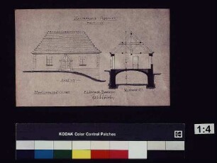
Kelterhaus Abstatt
Entwässerungsprojekt Abstatt
HK Abstatt
Rentamt Abstatt
Walddistrikt Fuchsrain [in der Gemarkung Abstatt]
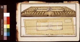
Temmelgarten zu Abstatt
Automatisiertes Liegenschaftsbuch Abstatt
[Grundstücke auf der Gemarkung Abstatt]
[Grundstücke auf der Gemarkung Abstatt]
Gemarkung Abstatt: Entwässerungsprojekt der Herrnbrückenwiesen
Kelterhaus Abstatt
Entwässerungsprojekt Abstatt
Kelterhaus Abstatt
Entwässerungsprojekt Abstatt
HK Abstatt
Rentamt Abstatt
Walddistrikt Fuchsrain [in der Gemarkung Abstatt]
Temmelgarten zu Abstatt