Archivale
o. T.
Längenprofil vom Königsweg bis zur Hammer Straße. Es handelt sich wohl um die Fritz-Pütter-Straße.
- Reference number
-
Slg-KUP, A 134,22,6
- Dimensions
-
Bl. 29,9 x 49,9
- Formal description
-
Pergamentpapier leicht geknickt und eingerissen.
- Further information
-
Ausführung: Zeichnung, koloriert
Maßstab: o. M.
- Context
-
Karten und Pläne >> 01. Stadtdarstellungen >> 01.04. Straßen und Plätze
- Holding
-
Slg-KUP Karten und Pläne
- Indexentry place
-
Fritz-Pütter-Straße
- Date of creation
-
o. D.
- Other object pages
- Delivered via
- Last update
-
17.09.2025, 2:55 PM CEST
Data provider
This object is provided by:
Stadtarchiv Münster. If you have any questions about the object, please contact the data provider.
Stadtarchiv Münster. If you have any questions about the object, please contact the data provider.
Object type
- Archivale
Time of origin
- o. D.
Other Objects (12)

Verwaltungsbericht der Ständischen Landarmendirektion der Neumark (Druckschrift)
Tätigkeit der Kreisleitung Gransee
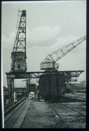
Kanalhafen
Statistik über Schüler- und Lehrerbüchereien
Neubau des "Alten" Stadtkrankenhauses
Bussardstraße 1-29
Rechtsstreit der evangelischen Pfarrei Eschelbach (Kl.) gegen die Standesherrschaft Hohenlohe-Waldenburg wegen der Qualität der Weinbesoldung
Alexandre Breffort Irma la Duce Bad Reichenhall o. J.
Forsthaus in Langensteinbach
Unterausteilungsberechnungen von Kettenacker
Haushaltsplan der Örtlichen Industrie des Bezirkes für das Rechnungsjahr 1953 und Planvorschläge für 1954 der Kreise

Hübner, Elias, Müller Bau einer Scheune mit Keller
Verwaltungsbericht der Ständischen Landarmendirektion der Neumark (Druckschrift)
Tätigkeit der Kreisleitung Gransee
Kanalhafen
Statistik über Schüler- und Lehrerbüchereien
Neubau des "Alten" Stadtkrankenhauses
Bussardstraße 1-29
Rechtsstreit der evangelischen Pfarrei Eschelbach (Kl.) gegen die Standesherrschaft Hohenlohe-Waldenburg wegen der Qualität der Weinbesoldung
Alexandre Breffort Irma la Duce Bad Reichenhall o. J.
Forsthaus in Langensteinbach
Unterausteilungsberechnungen von Kettenacker
Haushaltsplan der Örtlichen Industrie des Bezirkes für das Rechnungsjahr 1953 und Planvorschläge für 1954 der Kreise