Karte / Plan
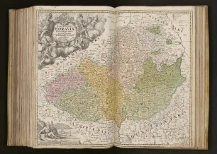
Mähren (Markgrafschaft), Historische Karten aus den Brünner Archiven, 1: Enthält: 1. Johann Christoph Müller, Marchionatus Moraviae circulus Iglaviensis, (1726 ?), 2. Johann Christoph Müller, Marchionatus Moraviae circulus Brunnensis, (1726 ?), 3. Johann Christoph Müller, Tabula Generalis marchionatus Moraviae in sex circulos divisae, (1728?), 4. Matthias Seutter, Moravia marchionatus in sex circulos divisus, (1736), 5. Tobias Conrad Lotter, Mappa geographica specialis marchionatus Moraviae, (1758) Farbige Nachdrucke
- Reference number
-
W 051, 49010
- Dimensions
-
Höhe: 50, Breite: 64,5
- Further information
-
Ort: Mähren (Markgrafschaft)
- Context
-
Karten A (Allgemein) >> 1. Topographische Karte, Übersichtskarten >> 1.3. Territorialkarten
- Holding
-
W 051 Karten A (Allgemein)
- Indexentry place
-
Mähren (Markgrafschaft)
- Date of creation
-
(1726, 1728, 1736, 1758)
- Other object pages
- Provenance
-
Sammlungsregistraturbildner
- Delivered via
- Last update
-
05.11.2025, 4:05 PM CET
Data provider
This object is provided by:
Landesarchiv Nordrhein-Westfalen. Abteilung Westfalen. If you have any questions about the object, please contact the data provider.
Landesarchiv Nordrhein-Westfalen. Abteilung Westfalen. If you have any questions about the object, please contact the data provider.
Object type
- Karten / Pläne
Time of origin
- (1726, 1728, 1736, 1758)
Other Objects (12)
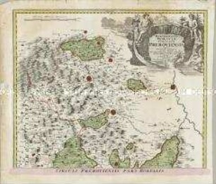
Marchionatus Moraviae Circulus Preroviensis

Marchionatus Moraviae Circulus Hradistiensis

Marchionatûs Moraviae Circulus Olomucensis
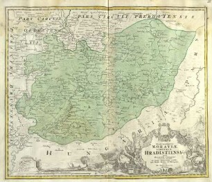
Marchionatus Moraviae Circulus Hradistiensis
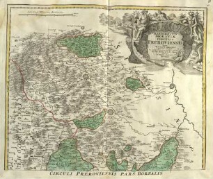
Marchionatus Moraviae Circulus Preroviensis
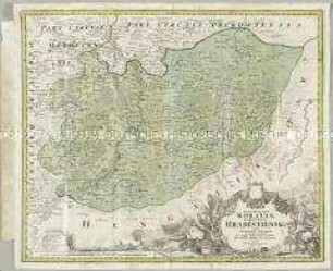
Marchionatus Moraviae Circulus Hradistiensis
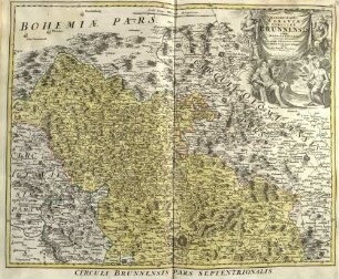
Marchionatus Moraviae Circulus Brunnensis
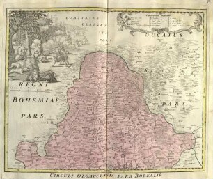
Marchionatus Moraviae Circulus Olomucensis

Marchionatus Moraviae

Marchionatus Moraviae
Tabula Generalis Marchionatus Moraviæ In Sex Circulos Divisæ
"Tabula generalis marchionatus Moraviae in sex circulos divisae ..."
Marchionatus Moraviae Circulus Preroviensis
Marchionatus Moraviae Circulus Hradistiensis
Marchionatûs Moraviae Circulus Olomucensis
Marchionatus Moraviae Circulus Hradistiensis
Marchionatus Moraviae Circulus Preroviensis
Marchionatus Moraviae Circulus Hradistiensis
Marchionatus Moraviae Circulus Brunnensis
Marchionatus Moraviae Circulus Olomucensis
Marchionatus Moraviae
Marchionatus Moraviae
Tabula Generalis Marchionatus Moraviæ In Sex Circulos Divisæ