Altkarte
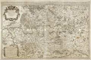
Franconiae, mappa locupletissima : = Land-Tafel Deß gesambten Fränkischen Crayses in 64. Blätter abgetheilt
- Weitere Titel
-
Land-Tafel Deß gesambten Fränkischen Crayses in 64. Blätter abgetheilt
- Standort
-
Bamberg, Staatsbibliothek -- HV.H.Franc.571
- Maße
-
je 19 x 14 cm
- Umfang
-
1 Kt. in 64 Teilen auf 64 Bl.
- Ausgabe
-
[3. Auflage]
- Sprache
-
Deutsch
- Anmerkungen
-
Kupferstich
Titelblatt fehlt. - Titel gemäß 1. u. 2. Aufl. - Lit. in: Bonacker: Grundriß d. fränkischen Kartographie d. 16. u. 17. Jh. - Mainfränk. Hefte, 33, 1959, S. 74
- Erschienen in
-
Sancti Romani Imperii Circuli Franconici oder das gantze Francken-Land mit Seinen Graentzen ; 1
- Schlagwort
-
Franken
Bayern
Fränkischer Reichskreis
- Ereignis
-
Veröffentlichung
- (wo)
-
Nürnberg
- (wer)
-
W. M. Endters seel. Erben u. J. A. Engelbrechts seel. Wittib.
- (wann)
-
1737
- Beteiligte Personen und Organisationen
- URN
-
urn:nbn:de:bvb:12-bsb11694237-9
- Letzte Aktualisierung
-
16.04.2025, 08:47 MESZ
Datenpartner
Dieses Objekt wird bereitgestellt von:
Bayerische Staatsbibliothek. Bei Fragen zum Objekt wenden Sie sich bitte an den Datenpartner.
Bayerische Staatsbibliothek. Bei Fragen zum Objekt wenden Sie sich bitte an den Datenpartner.
Objekttyp
- Altkarte
Beteiligte
- Jung, Georg Conrad
- W. M. Endters seel. Erben u. J. A. Engelbrechts seel. Wittib.
Entstanden
- 1737
Ähnliche Objekte (12)
gesambten

Landtafel
Landtafel
Landtafel
Landtafel
Circulus Franconiae

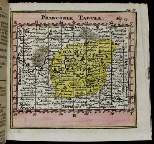
Franconiae Tabula
Franconiæ Tabula.

Franconiæ Tabvla.
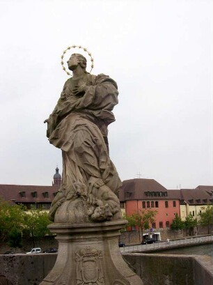
Patrona Franconiae
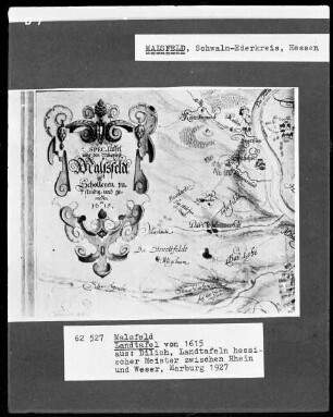
Malsfeld, Landtafel
Bayerische Landtafel.
gesambten
Landtafel
Landtafel
Landtafel
Landtafel
Circulus Franconiae
Franconiae Tabula
Franconiæ Tabula.
Franconiæ Tabvla.
Patrona Franconiae
Malsfeld, Landtafel
Bayerische Landtafel.
gesambten
Landtafel
Landtafel
Landtafel
Landtafel
Circulus Franconiae
Franconiae Tabula
Franconiæ Tabula.
Franconiæ Tabvla.
Patrona Franconiae
Malsfeld, Landtafel