- Alternative title
-
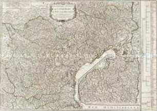
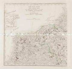
LES DIFFERENTES ROUTES / Pour Aller / de PARIS a ROME / et aux Villes considerables d'Italie, ou
- Location
-
Deutsches Historisches Museum, Berlin
- Inventory number
-
Do 2006/84
- Measurements
-
Höhe x Breite: 34,3 x 42,6 cm (Blatt)
Höhe x Breite: 24,2 x 32,9 cm (Karte)
Höhe x Breite: 25,3 x 34 cm (Platte)
- Material/Technique
-
Druckfarbe, Papier, Kupferstich
- Classification
-
Kartografie (Gattung)
- Subject (what)
-
Frankreich
Italien
- Event
-
Herstellung
- (who)
-
Geograph, Kupferstecher, Verleger: Jean-Baptiste Nolin (1657)
- (where)
-
Paris, Frankreich
- (when)
-
1701
- Rights
-
Deutsches Historisches Museum
- Last update
-
24.03.2023, 9:28 AM CET
Data provider
This object is provided by:
Stiftung Deutsches Historisches Museum. If you have any questions about the object, please contact the data provider.
Stiftung Deutsches Historisches Museum. If you have any questions about the object, please contact the data provider.
Object type
- Regionalkarte
Associated
- Geograph, Kupferstecher, Verleger: Jean-Baptiste Nolin (1657)
Time of origin
- 1701
Other Objects (12)
Gouvernement généraux de Languedoc. Mit einer Nebenkarte: Supplément pour les Cévennes
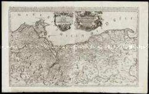
Grand Atlas . Bl. 20 (Geldern, Cleve, Holland, Utrecht): Contenant une Partie des Duchés de Gueldres et de Cleves du Comté d'Hollande, la Province d'Utrecht, Baronie de Breda, Metairie de Bois le Duc, et de differentes autres Seigneuries
Grand Atlas . Bl. 11 (Holland, Westfriesland): Contenant une Partie des Provinces Unies, savoir la Province de Friesland Occidentale, une Partie d'Over Yssel, de Gueldre, d'Hollande Septentrionale, de differentes Isles de la Meer d'Allemagne, et du Zuider See.
Grand Atlas . Bl. 55 (Frankreich): Pour servir de Suite au grand Atlas d'Allemagne

Carte des Isles Britanniques. Mit einer Nebenkarte: Suplément pour les Isles Orcades et de Schetland
Carte d'une partie des Pays-Bas, pour servir de Supplement a la Carte de l'Empire d'Allemagne
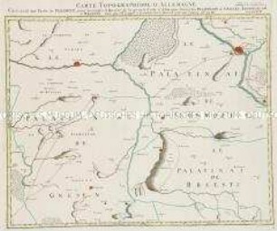
Grand Atlas . Bl. 18 (Polen. Gnesen): Contenant une Partie de Pologne, pour acclompir le Quarre de la grande Carte d'Allemagne, savoir les Palatinats de Gnesen, Inowrozlaw, et Brsestz.
Das Hertzogthum Pommern
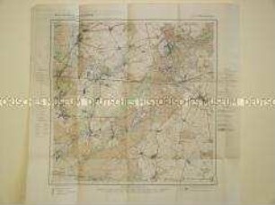
Landkarte aus der Serie "Berlin und Umgebung", Blatt 8: Strausberg

Ducatus Breslanus
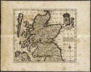
Scotiae Regnum / Königreich Schottland.
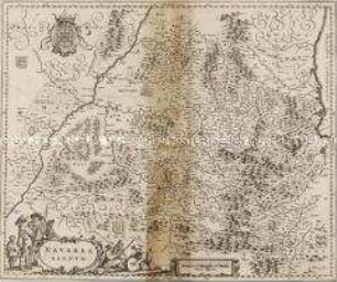
Navarra Regnum
Gouvernement généraux de Languedoc. Mit einer Nebenkarte: Supplément pour les Cévennes
Grand Atlas . Bl. 20 (Geldern, Cleve, Holland, Utrecht): Contenant une Partie des Duchés de Gueldres et de Cleves du Comté d'Hollande, la Province d'Utrecht, Baronie de Breda, Metairie de Bois le Duc, et de differentes autres Seigneuries
Grand Atlas . Bl. 11 (Holland, Westfriesland): Contenant une Partie des Provinces Unies, savoir la Province de Friesland Occidentale, une Partie d'Over Yssel, de Gueldre, d'Hollande Septentrionale, de differentes Isles de la Meer d'Allemagne, et du Zuider See.
Grand Atlas . Bl. 55 (Frankreich): Pour servir de Suite au grand Atlas d'Allemagne
Carte des Isles Britanniques. Mit einer Nebenkarte: Suplément pour les Isles Orcades et de Schetland
Carte d'une partie des Pays-Bas, pour servir de Supplement a la Carte de l'Empire d'Allemagne
Grand Atlas . Bl. 18 (Polen. Gnesen): Contenant une Partie de Pologne, pour acclompir le Quarre de la grande Carte d'Allemagne, savoir les Palatinats de Gnesen, Inowrozlaw, et Brsestz.
Das Hertzogthum Pommern
Landkarte aus der Serie "Berlin und Umgebung", Blatt 8: Strausberg
Ducatus Breslanus
Scotiae Regnum / Königreich Schottland.