Karten / Pläne
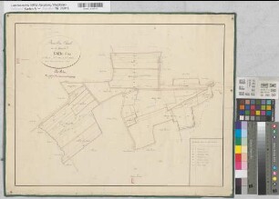
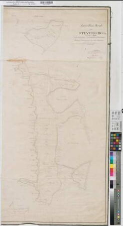
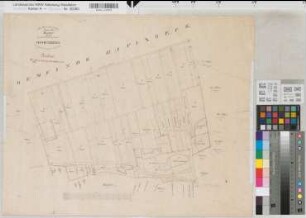
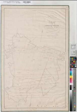
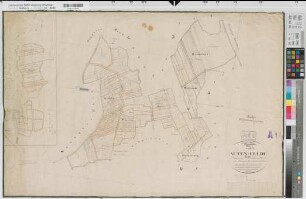
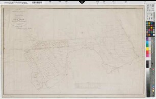
Nottuln (Nottuln), Teilung der Gemeinheit Hanloermark und Horst, Brouillonkarte
- Reference number
-
W 051, 29991
- Dimensions
-
Höhe: 58, Breite: 113, Maßstab: 1:2500
- Context
-
Karten A (Allgemein) >> 11. Landesamt für Agrarordnung >> 11.296. Nottuln (Nottuln), Teilung der Gemeinheit Hanloermark und Horst
- Holding
-
W 051 Karten A (Allgemein)
- Date of creation
-
1824
- Other object pages
- Delivered via
- Last update
-
24.06.2025, 1:42 PM CEST
Data provider
This object is provided by:
Landesarchiv Nordrhein-Westfalen. Abteilung Westfalen. If you have any questions about the object, please contact the data provider.
Landesarchiv Nordrhein-Westfalen. Abteilung Westfalen. If you have any questions about the object, please contact the data provider.
Object type
- Karten / Pläne
Time of origin
- 1824
Other Objects (12)
Nottuln (Nottuln), Teilung der Gemeinheit Dill, Brouillonkarte
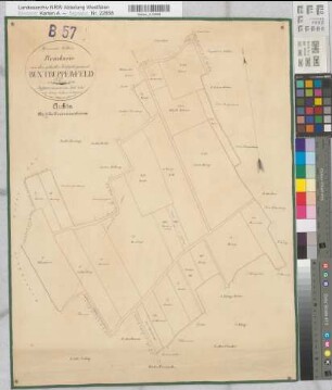
Nottuln (Nottuln), Teilung der Gemeinheit Buxtrupper Feld, Brouillonkarte
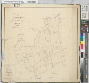
Nottuln (Nottuln), Teilung der Gemeinheit Hanloermark und Horst, Reinkarte
Nottuln (Nottuln), Teilung des Schlickfeldes, Brouillonkarte
Nottuln (Nottuln), Teilung des Steverbergs, Brouillonkarte

Nottuln (Nottuln), Teilung der Gemeinheit Dill, Reinkarte
Nottuln (Nottuln), Teilung des Vödefeldes Hoheberg, Brouillonkarte
Nottuln (Nottuln), Teilung der Struckforter Mark, Brouillonkarte
Nottuln (Nottuln), Teilung des Voedefeld Altefeld, Brouillonkarte
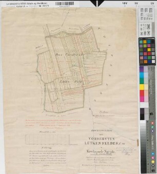
Nottuln (Nottuln), Teilung des vordersten Lütkenfeldes, Brouillonkarte
Nottuln (Nottuln), Teilung der Gemeinheit Buxtrupper Feld, Reinkarte
Nottuln (Nottuln), Teilung der Steverheide, Brouillonkarte Sektion II
Nottuln (Nottuln), Teilung der Gemeinheit Dill, Brouillonkarte
Nottuln (Nottuln), Teilung der Gemeinheit Buxtrupper Feld, Brouillonkarte
Nottuln (Nottuln), Teilung der Gemeinheit Hanloermark und Horst, Reinkarte
Nottuln (Nottuln), Teilung des Schlickfeldes, Brouillonkarte
Nottuln (Nottuln), Teilung des Steverbergs, Brouillonkarte
Nottuln (Nottuln), Teilung der Gemeinheit Dill, Reinkarte
Nottuln (Nottuln), Teilung des Vödefeldes Hoheberg, Brouillonkarte
Nottuln (Nottuln), Teilung der Struckforter Mark, Brouillonkarte
Nottuln (Nottuln), Teilung des Voedefeld Altefeld, Brouillonkarte
Nottuln (Nottuln), Teilung des vordersten Lütkenfeldes, Brouillonkarte
Nottuln (Nottuln), Teilung der Gemeinheit Buxtrupper Feld, Reinkarte