- Alternative title
-
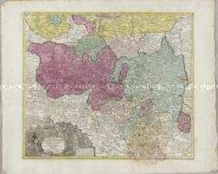
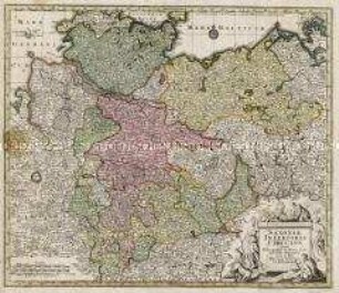
MARCHIONATUS / LUSATIAE / INFERIORIS / BOHEMIAE olim REGNO
- Location
-
Deutsches Historisches Museum, Berlin
- Inventory number
-
Do 2006/621
- Measurements
-
Höhe x Breite: 59,3 x 72 cm (Blatt)
Höhe x Breite: 46,7 x 55,2 cm (Karte)
Höhe x Breite: 49,8 x 58,3 cm (Platte)
- Material/Technique
-
Papier, Kupferstich, koloriert
- Classification
-
Kartografie (Gattung)
- Subject (what)
-
Lausitz
Niederlausitz
Brandenburg
- Event
-
Herstellung
- (who)
-
Stecher, Verleger, Geograph: Tobias Konrad Lotter
- (where)
-
Augsburg, Deutschland
- (when)
-
um 1760
- Rights
-
Deutsches Historisches Museum
- Last update
-
24.03.2023, 9:29 AM CET
Data provider
This object is provided by:
Stiftung Deutsches Historisches Museum. If you have any questions about the object, please contact the data provider.
Stiftung Deutsches Historisches Museum. If you have any questions about the object, please contact the data provider.
Object type
- Kreiskarte
Associated
- Stecher, Verleger, Geograph: Tobias Konrad Lotter
Time of origin
- um 1760
Other Objects (12)
Marchionatus Lusatiae Superioris
![Karte der Niederlausitz, 1:290 000, Kupferstich., 1714 : Mappa Geographica Marchionatus Lusatiae Inferioris / J. L. Blanck fe.. - [Ca. 1:290 000]. - [S.l.] , [1714]. - 1 Kt. : Kupferst. ; 36 x 37 cm](https://iiif.deutsche-digitale-bibliothek.de/image/2/7557648b-f619-4b18-9bda-443af02711be/full/!306,450/0/default.jpg)
Karte der Niederlausitz, 1:290 000, Kupferstich., 1714 : Mappa Geographica Marchionatus Lusatiae Inferioris / J. L. Blanck fe.. - [Ca. 1:290 000]. - [S.l.] , [1714]. - 1 Kt. : Kupferst. ; 36 x 37 cm
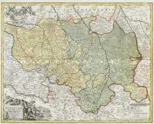
Lusatiae Superioris
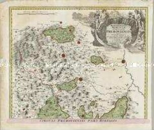
Marchionatus Moraviae Circulus Preroviensis
Marchionatus Moraviae Circulus Hradistiensis
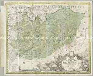
Saxoniae Inferioris Circulus
![Karte der Niederlausitz, 1:170 000, Kupferstich., vor 1726 : Nova et accurata Descriptio Marchionatus Lusatiae Inferioris oder Neue und accurate Beschreibung der Margrafthums Nieder-Lausitz / gestochen von Peter Schencken jun. - [Ca. 1:170 000]. - Amsterdam , [vor 1726]. - 1 Kt. : Kupferst. ; 54 x 41 cm](https://iiif.deutsche-digitale-bibliothek.de/image/2/e9dc3a9e-9b55-47f5-bad4-42a246eec9e1/full/!306,450/0/default.jpg)
Karte der Niederlausitz, 1:170 000, Kupferstich., vor 1726 : Nova et accurata Descriptio Marchionatus Lusatiae Inferioris oder Neue und accurate Beschreibung der Margrafthums Nieder-Lausitz / gestochen von Peter Schencken jun. - [Ca. 1:170 000]. - Amsterdam , [vor 1726]. - 1 Kt. : Kupferst. ; 54 x 41 cm
![Karte der Niederlausitz, 1:250 000, Kupferstich., 1759 : Le Marquisat De Basse-Lusace : Divisé en ses Cercles, Seigneuries et Senechaussées &c. = Marchionatus Lusatiae Inferioris Tabula / L. Schenk J. Soon sculpsit. - [Ca. 1:250 000]. - Amsterdam : Covens et Mortier , 1759. - 1 Kt. : kolor. Kupferst. ; 56 x 42 cm](https://iiif.deutsche-digitale-bibliothek.de/image/2/90b2d122-6fbd-4a1e-81bb-4426f391c0b6/full/!306,450/0/default.jpg)
Karte der Niederlausitz, 1:250 000, Kupferstich., 1759 : Le Marquisat De Basse-Lusace : Divisé en ses Cercles, Seigneuries et Senechaussées &c. = Marchionatus Lusatiae Inferioris Tabula / L. Schenk J. Soon sculpsit. - [Ca. 1:250 000]. - Amsterdam : Covens et Mortier , 1759. - 1 Kt. : kolor. Kupferst. ; 56 x 42 cm
![Karte der Niederlausitz, 1:180 000, Kupferstich., um 1724 : Accuratissima Marchionatus Lusatiae Inferioris Descriptio : Mit Königl. Preussischen Allergnädigsten Privilegio / gezeichnet von J. P. F. von Gundling. G. P. Busch sculpsit et excudit. - [Ca. 1:180 000]. - Berolini , [um 1724]. - 1 Kt. : kolor. Kupferst. ; 55 x 47 cm](https://iiif.deutsche-digitale-bibliothek.de/image/2/9b8b82eb-893c-4022-95de-ba0130d0c389/full/!306,450/0/default.jpg)
Karte der Niederlausitz, 1:180 000, Kupferstich., um 1724 : Accuratissima Marchionatus Lusatiae Inferioris Descriptio : Mit Königl. Preussischen Allergnädigsten Privilegio / gezeichnet von J. P. F. von Gundling. G. P. Busch sculpsit et excudit. - [Ca. 1:180 000]. - Berolini , [um 1724]. - 1 Kt. : kolor. Kupferst. ; 55 x 47 cm
![Karte der Lausitz, 1:330 000, Kupferstich, nach 1715 : Totius Marchionatus Lusatiae tam Superioris quam Inferioris tabula specialis : in suos comitatus et dominatus distincta / revisa et aucta a Ioh. Hübnero. - [Ca. 1:330 000]. - Norimbergae : Io. Bapt. Homann , [nach 1715]. - 1 Kt. : Kupferst. ; 55 x 46 cm](https://iiif.deutsche-digitale-bibliothek.de/image/2/d165a82d-d633-41d5-a0ff-c70aab088a6c/full/!306,450/0/default.jpg)
Karte der Lausitz, 1:330 000, Kupferstich, nach 1715 : Totius Marchionatus Lusatiae tam Superioris quam Inferioris tabula specialis : in suos comitatus et dominatus distincta / revisa et aucta a Ioh. Hübnero. - [Ca. 1:330 000]. - Norimbergae : Io. Bapt. Homann , [nach 1715]. - 1 Kt. : Kupferst. ; 55 x 46 cm
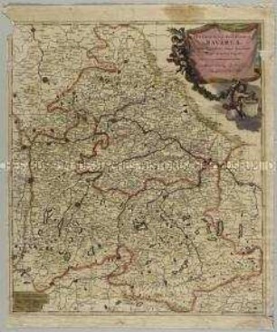
Superioris ac Inferioris Bavariae
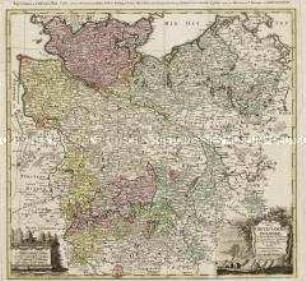
Repraesentationem hancce Circuli Saxonici Inferioris
Marchionatus Lusatiae Superioris
Karte der Niederlausitz, 1:290 000, Kupferstich., 1714 : Mappa Geographica Marchionatus Lusatiae Inferioris / J. L. Blanck fe.. - [Ca. 1:290 000]. - [S.l.] , [1714]. - 1 Kt. : Kupferst. ; 36 x 37 cm
Lusatiae Superioris
Marchionatus Moraviae Circulus Preroviensis
Marchionatus Moraviae Circulus Hradistiensis
Saxoniae Inferioris Circulus
Karte der Niederlausitz, 1:170 000, Kupferstich., vor 1726 : Nova et accurata Descriptio Marchionatus Lusatiae Inferioris oder Neue und accurate Beschreibung der Margrafthums Nieder-Lausitz / gestochen von Peter Schencken jun. - [Ca. 1:170 000]. - Amsterdam , [vor 1726]. - 1 Kt. : Kupferst. ; 54 x 41 cm
Karte der Niederlausitz, 1:250 000, Kupferstich., 1759 : Le Marquisat De Basse-Lusace : Divisé en ses Cercles, Seigneuries et Senechaussées &c. = Marchionatus Lusatiae Inferioris Tabula / L. Schenk J. Soon sculpsit. - [Ca. 1:250 000]. - Amsterdam : Covens et Mortier , 1759. - 1 Kt. : kolor. Kupferst. ; 56 x 42 cm
Karte der Niederlausitz, 1:180 000, Kupferstich., um 1724 : Accuratissima Marchionatus Lusatiae Inferioris Descriptio : Mit Königl. Preussischen Allergnädigsten Privilegio / gezeichnet von J. P. F. von Gundling. G. P. Busch sculpsit et excudit. - [Ca. 1:180 000]. - Berolini , [um 1724]. - 1 Kt. : kolor. Kupferst. ; 55 x 47 cm
Karte der Lausitz, 1:330 000, Kupferstich, nach 1715 : Totius Marchionatus Lusatiae tam Superioris quam Inferioris tabula specialis : in suos comitatus et dominatus distincta / revisa et aucta a Ioh. Hübnero. - [Ca. 1:330 000]. - Norimbergae : Io. Bapt. Homann , [nach 1715]. - 1 Kt. : Kupferst. ; 55 x 46 cm
Superioris ac Inferioris Bavariae