- Alternative title
-
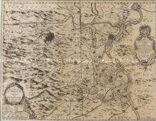
THE COUNTRY / TWENTY-FIVE MILES / ROUND LONDON, / planned from a SCALE of ONE MILE to an INCH.
- Location
-
Deutsches Historisches Museum, Berlin
- Inventory number
-
Do 2006/274.1-4
- Measurements
-
Höhe x Breite: 57,5 x 78,5 cm (Blatt 4)
Höhe x Breite: 50 x 60,7 cm (Karte 4)
Höhe x Breite: 52,5 x 64 cm (Platte 4)
- Material/Technique
-
Druckfarbe, Papier, Kupferstich, koloriert
- Classification
-
Kartografie (Gattung)
- Subject (what)
-
London
England
Großbritannien
- Event
-
Herstellung
- (who)
-
Kartograf, Verleger: William Faden
- (where)
-
London, Großbritannien und Nordirland
- (when)
-
1789
- Rights
-
Deutsches Historisches Museum
- Last update
-
24.03.2023, 9:30 AM CET
Data provider
This object is provided by:
Stiftung Deutsches Historisches Museum. If you have any questions about the object, please contact the data provider.
Stiftung Deutsches Historisches Museum. If you have any questions about the object, please contact the data provider.
Object type
- Regionalkarte
Associated
- Kartograf, Verleger: William Faden
Time of origin
- 1789
Other Objects (12)
![[Twenty-five Kozuka]](https://iiif.deutsche-digitale-bibliothek.de/image/2/f3fcb3c5-cf78-4c57-8d4b-213b8ccace16/full/!306,450/0/default.jpg)
[Twenty-five Kozuka]

Twenty-five annotated games
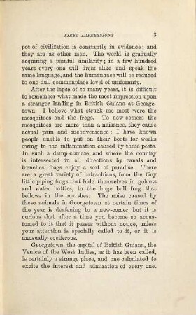
Twenty-five years in British Guiana
La Province d'Alsace

Carte Générale de l'Empire d'Allemagne. Mit einer Übersichtskarte
Carte des environs de la Mer-Noire
Carte Geographique representant le cours entier du Rhin, de la Moselle, de la Meuse et de l'Escaut

Kolorierte Tuschfederzeichnung der Grafschaft Eger
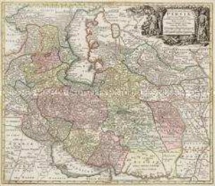
Opulentissimi Regni Persiae iuxta suas Provincias
La Principauté d'Orange et Comtat de Venaissin

Icon Sinus Baiarum
Karte: Beschreibung der Schweiz
[Twenty-five Kozuka]
Twenty-five annotated games
Twenty-five years in British Guiana
La Province d'Alsace
Carte Générale de l'Empire d'Allemagne. Mit einer Übersichtskarte
Carte des environs de la Mer-Noire
Carte Geographique representant le cours entier du Rhin, de la Moselle, de la Meuse et de l'Escaut
Kolorierte Tuschfederzeichnung der Grafschaft Eger
Opulentissimi Regni Persiae iuxta suas Provincias
La Principauté d'Orange et Comtat de Venaissin
Icon Sinus Baiarum