- Alternative title
-
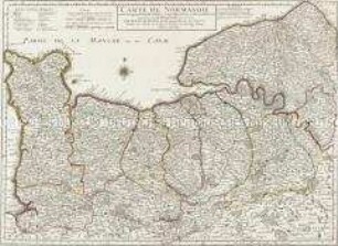
CARTE / DE / Normandie.
- Location
-
Deutsches Historisches Museum, Berlin
- Inventory number
-
Do 2006/90
- Measurements
-
Höhe x Breite: 44,5 x 58 cm (Blatt)
Höhe x Breite: 34,4 x 49,3 cm (Karte)
Höhe x Breite: 37,5 x 52,5 cm (Platte)
- Material/Technique
-
Druckfarbe, Papier, Kupferstich
- Classification
-
Kartografie (Gattung)
- Subject (what)
-
Frankreich
Normandie
- Event
-
Herstellung
- (where)
-
Frankreich ?
- (when)
-
um 1650
- Rights
-
Deutsches Historisches Museum
- Last update
-
01.04.2024, 2:49 AM CEST
Data provider
This object is provided by:
Stiftung Deutsches Historisches Museum. If you have any questions about the object, please contact the data provider.
Stiftung Deutsches Historisches Museum. If you have any questions about the object, please contact the data provider.
Object type
- Regionalkarte
Time of origin
- um 1650
Other Objects (12)
Carte de Normandie
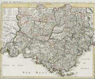
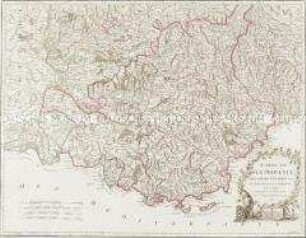
Carte de Provence
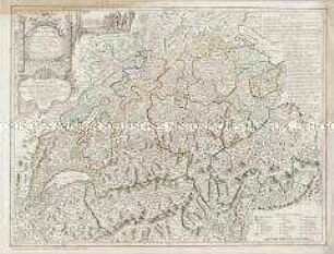
Carte de Suisse
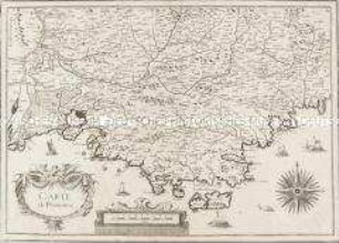
Carte de Provence
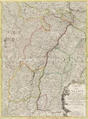
Carte de l'Alsace
Carte de la Provence
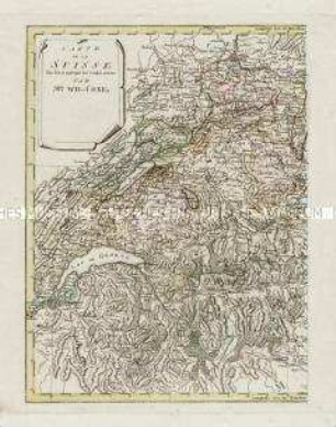
Carte de la Suisse
Carte de la Suisse
Carte de la Babylonie
Carte de l'Electorat de Brandebourg

Carte de la Principauté de Halberstadt

Carte des environs de Boston
Carte de Normandie
Carte de Provence
Carte de Suisse
Carte de Provence
Carte de l'Alsace
Carte de la Provence
Carte de la Suisse
Carte de la Suisse
Carte de la Babylonie
Carte de l'Electorat de Brandebourg
Carte de la Principauté de Halberstadt
Carte des environs de Boston
Carte de Normandie
Carte de Provence
Carte de Suisse
Carte de Provence
Carte de l'Alsace
Carte de la Provence
Carte de la Suisse
Carte de la Suisse
Carte de la Babylonie
Carte de l'Electorat de Brandebourg
Carte de la Principauté de Halberstadt