Karten / Pläne
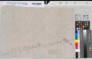
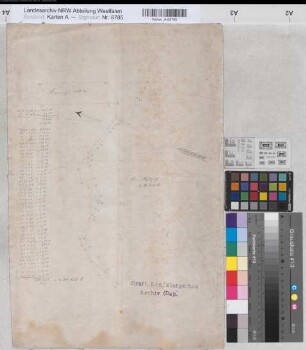
Dellwig (Dortmund) Lageplan des Rittergutes Ende 19.Jh. (1 : 2500) 45 x 43 kol. Zeichnung Landsberg-Velen Nr. 220
- Reference number
-
W 051, 8787
- Former reference number
-
Landsberg-Velen 220
- Further information
-
Ort: Dellwig, Dortmund
- Context
-
Karten A (Allgemein) >> 7. Bausachen >> 7.3. Lageplan
- Holding
-
W 051 Karten A (Allgemein)
- Indexentry place
-
Dellwig, Dortmund
Dellwig, Rittergut, Lageplan, 1890
- Provenance
-
Sammlungsregistraturbildner
- Date of creation
-
1890
- Other object pages
- Delivered via
- Last update
-
30.04.2025, 2:37 PM CEST
Data provider
This object is provided by:
Landesarchiv Nordrhein-Westfalen. Abteilung Westfalen. If you have any questions about the object, please contact the data provider.
Landesarchiv Nordrhein-Westfalen. Abteilung Westfalen. If you have any questions about the object, please contact the data provider.
Object type
- Karten / Pläne
Associated
- Sammlungsregistraturbildner
Time of origin
- 1890
Other Objects (12)
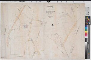
Straßenführung 2.H. 19.Jh. (1 : 2500) 36 x 54 Zeichnung Landsberg-Velen Nr. 439
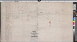
Dellwig (Dortmund) Katasterauszug 1903 1 : 2500 67 x 101 Zeichnung Katasteramt Landsberg-Velen Nr. 187
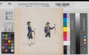
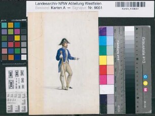
Uniformen 1.H. 19.Jh. 23 x 24 Aquarell Landsberg-Velen Nr. 705a
Ritterhof bei Mengede (Dortmund) Flurkarte des Gutes Ritterhof 2.H. 19.Jh. (1 : 2500) 71 x 103 Kopie Landsberg-Velen Nr. 301
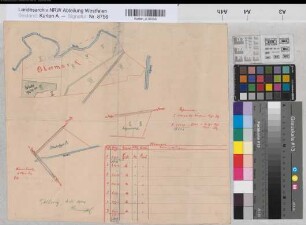
Dortmund (Dortmund) Vermessung des Grundstücks Am Kohlpott Mitte 19.Jh. (1 : 2500) 51 x 33,5 Zeichnung Landsberg-Velen Nr. 218
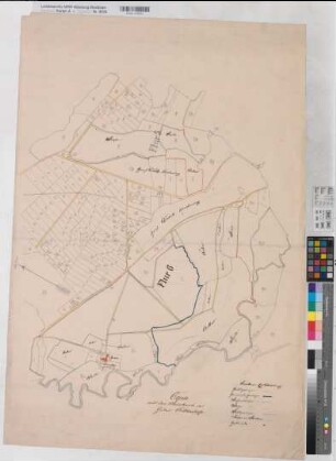
Dellwig (Dortmund) Besitzungen des Freiherrn von Rump 1880 1 : 2500 65 x 120 Zeichnung Thüer, Förster Landsberg-Velen Nr. 661
Uniformen 1.H. 19.Jh. 24 x 16,5 Aquarell Landsberg-Velen Nr. 705b
Crange (Herne) Dellwig (Dortmund) Forstgrundstücke mit Register 1904 (1 : 2500) 35 x 39 kol. Zeichnung H. Kimmel Landsberg-Velen Nr. 78

Gemeinde/Gemarkung: Dellwig Band/Anfang: 0 Blatt/Anfang: 220
Dellwig, Schulze Dellwig (Fröndenberg)
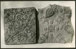
Druckstöcke, 19.Jh.
![[Männerportrait] 19.Jh.](https://iiif.deutsche-digitale-bibliothek.de/image/2/f97714a2-c19f-43da-9f63-e2be8e345b76/full/!306,450/0/default.jpg)
[Männerportrait] 19.Jh.
Straßenführung 2.H. 19.Jh. (1 : 2500) 36 x 54 Zeichnung Landsberg-Velen Nr. 439
Dellwig (Dortmund) Katasterauszug 1903 1 : 2500 67 x 101 Zeichnung Katasteramt Landsberg-Velen Nr. 187
Uniformen 1.H. 19.Jh. 23 x 24 Aquarell Landsberg-Velen Nr. 705a
Ritterhof bei Mengede (Dortmund) Flurkarte des Gutes Ritterhof 2.H. 19.Jh. (1 : 2500) 71 x 103 Kopie Landsberg-Velen Nr. 301
Dortmund (Dortmund) Vermessung des Grundstücks Am Kohlpott Mitte 19.Jh. (1 : 2500) 51 x 33,5 Zeichnung Landsberg-Velen Nr. 218
Dellwig (Dortmund) Besitzungen des Freiherrn von Rump 1880 1 : 2500 65 x 120 Zeichnung Thüer, Förster Landsberg-Velen Nr. 661
Uniformen 1.H. 19.Jh. 24 x 16,5 Aquarell Landsberg-Velen Nr. 705b
Crange (Herne) Dellwig (Dortmund) Forstgrundstücke mit Register 1904 (1 : 2500) 35 x 39 kol. Zeichnung H. Kimmel Landsberg-Velen Nr. 78
Gemeinde/Gemarkung: Dellwig Band/Anfang: 0 Blatt/Anfang: 220
Dellwig, Schulze Dellwig (Fröndenberg)
Druckstöcke, 19.Jh.