Geografische Karte
Geografische Karte der niederländischen Kolonien (Ostindien)
- Alternative title
-
Sleswijk's Kaart van Nederlandsch Oost-Indie
- Location
-
Deutsches Historisches Museum, Berlin
- Inventory number
-
Do 73/686I
- Measurements
-
Höhe x Breite: 81 x 106 cm
- Material/Technique
-
Papier, gedruckt
- Classification
-
Kartografie (Gattung)
- Subject (what)
-
Geographie
Kolonialismus
- Event
-
Herstellung
- (who)
-
Herausgeber: J. A. Sleeswijk
- (where)
-
Bussum, Niederlande
- (when)
-
um 1925
- Rights
-
Deutsches Historisches Museum
- Last update
-
24.03.2023, 9:31 AM CET
Data provider
This object is provided by:
Stiftung Deutsches Historisches Museum. If you have any questions about the object, please contact the data provider.
Stiftung Deutsches Historisches Museum. If you have any questions about the object, please contact the data provider.
Object type
- Geografische Karte
Associated
- Herausgeber: J. A. Sleeswijk
Time of origin
- um 1925
Other Objects (12)

Geografische Karte des Saarlandes
Geografische Karte des Mittelmeerraumes
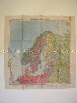
Geografische Karte von Nordeuropa
Geografische Karte des Argonnenwaldes
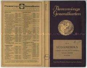
Geografische Karte von Südamerika - Nachlass

Geografische Karte der Bundesrepublik Deutschland
Geografische Karte der estnischen Ostseeküste
Geografische Karte von Schleswig-Holstein
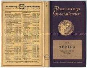
Geografische Karte von Afrika - Nachlass
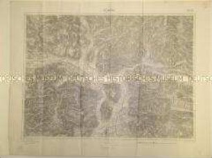
Geografische Karte eines Alpen-Abschnittes
Geografische Karte der Umgebung von Reims

Geografische Karte für die Wehrmacht (Tornisterschrift)
Geografische Karte des Saarlandes
Geografische Karte des Mittelmeerraumes
Geografische Karte von Nordeuropa
Geografische Karte des Argonnenwaldes
Geografische Karte von Südamerika - Nachlass
Geografische Karte der Bundesrepublik Deutschland
Geografische Karte der estnischen Ostseeküste
Geografische Karte von Schleswig-Holstein
Geografische Karte von Afrika - Nachlass
Geografische Karte eines Alpen-Abschnittes
Geografische Karte der Umgebung von Reims