- Location
-
München, Bayerische Staatsbibliothek -- Mapp. XI,91 mv-3
- Dimensions
-
54 x 47 cm
- Extent
-
1 Kt.
- Language
-
Deutsch
- Notes
-
Lithographie
Mit 2 Stadtpl.: Plan von Speyer mit Umgebung. Plan von Landau mit Umgebung. - Maßstab in graph. Form (Geograph. auch bayrsche Poststunden)
- Keyword
-
Pfalz
- Event
-
Veröffentlichung
- (where)
-
Nürnberg
- (who)
-
Lotzbeck
- (when)
-
[1874]
- Contributor
- URN
-
urn:nbn:de:bvb:12-bsb00012443-7
- Last update
-
27.11.2025, 8:35 AM CET
Data provider
This object is provided by:
Bayerische Staatsbibliothek. If you have any questions about the object, please contact the data provider.
Bayerische Staatsbibliothek. If you have any questions about the object, please contact the data provider.
Object type
- Karte
Associated
Time of origin
- [1874]
Other Objects (12)

Ober-Bayern des Königreichs Bayern

Niederbayern des Königreichs Bayern

Karte vom Königreich Bayern

Neuste Statistik des königreiches Bayern und seiner acht Kreise

Neueste Statistik des königreiches Bayern und seiner acht Kreise ...

Neuste Statistik des königreiches Bayern und seiner acht Kreise

Statistische Angaben über das Königreich Bayern nach den neuesten gesetzlichen Bestimmungen und sonstigen sicheren Quellen zusammengestellt

Statistische Angaben über das Königreich Bayern : nach den neuesten gesetzlichen Bestimmungen und sonstigen sichern Quellen zusammengestellt ; enthaltend: Eintheilung, Grösse, Bevölkerung, weltliche und kirchliche Behörden, Anstalten für Wissenschaft, Kunst, Unterricht und Verkehr, Armee, Badeorte, Gebirge, Flüsse, Seen, Städte mit Bevölkerung

Neueste Statistik des Königreiches Bayern und seiner acht Kreise : Genaue Angabe der Gerichtshöfe und Gerichtsbehörden nach der neuesten Organisation Central- und Kreisstellen, der obersten Kirchenstellen, der höheren Lehranstalten, Landgerichte, Rent-, Forst-, Berg-, Salz-, Post-, Telegraphen- und anderen Aemtern, Baubehörden, Klöster, Gebirge, Seen, Flüsse, Bäder, Eisenbahnen, Dampfschifffahrten, Höhenlage der bedeutenderen Städte und Orte, dann der höchsten Berge über der Meeresfläche, Zolllocalstatus etc.
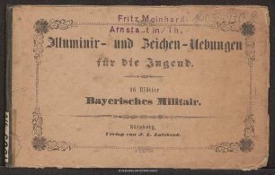
Illuminir- und Zeichen-Uebungen für die Jugend : 16 Blätter Bayerisches Militair
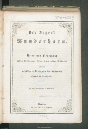
Der Jugend Wunderhorn : Reim- und Liederschatz aus den Werken unserer Dichter, so wie aus dem Volksmunde für die verschiedenen Stufenjahre der Kinderwelt gesammelt und herausgegeben

Neueste Schreib- und Leseschule : die ersten gleichzeitig beginnenden und stufenweise mit einander fortschreitenden Uebungen im Lesen, Schönschreiben, Diktandoschreiben und Rechtschreiben ; zugleich Aufgabenstoff bei Anfangs-Uebungen im Sprach-Unterricht ; ein Vorgänger zu jedem Lesebuche
Ober-Bayern des Königreichs Bayern
Niederbayern des Königreichs Bayern
Karte vom Königreich Bayern
Neuste Statistik des königreiches Bayern und seiner acht Kreise
Neueste Statistik des königreiches Bayern und seiner acht Kreise ...
Neuste Statistik des königreiches Bayern und seiner acht Kreise
Statistische Angaben über das Königreich Bayern nach den neuesten gesetzlichen Bestimmungen und sonstigen sicheren Quellen zusammengestellt
Statistische Angaben über das Königreich Bayern : nach den neuesten gesetzlichen Bestimmungen und sonstigen sichern Quellen zusammengestellt ; enthaltend: Eintheilung, Grösse, Bevölkerung, weltliche und kirchliche Behörden, Anstalten für Wissenschaft, Kunst, Unterricht und Verkehr, Armee, Badeorte, Gebirge, Flüsse, Seen, Städte mit Bevölkerung
Neueste Statistik des Königreiches Bayern und seiner acht Kreise : Genaue Angabe der Gerichtshöfe und Gerichtsbehörden nach der neuesten Organisation Central- und Kreisstellen, der obersten Kirchenstellen, der höheren Lehranstalten, Landgerichte, Rent-, Forst-, Berg-, Salz-, Post-, Telegraphen- und anderen Aemtern, Baubehörden, Klöster, Gebirge, Seen, Flüsse, Bäder, Eisenbahnen, Dampfschifffahrten, Höhenlage der bedeutenderen Städte und Orte, dann der höchsten Berge über der Meeresfläche, Zolllocalstatus etc.
Illuminir- und Zeichen-Uebungen für die Jugend : 16 Blätter Bayerisches Militair
Der Jugend Wunderhorn : Reim- und Liederschatz aus den Werken unserer Dichter, so wie aus dem Volksmunde für die verschiedenen Stufenjahre der Kinderwelt gesammelt und herausgegeben