Topographische Karten
Topografische Karte des Gebietes von Pillkallen und Wischwill (Ostpreußen)
- Alternative title
-
Reichskarte / Einheitsblatt 6
- Location
-
Deutsches Historisches Museum, Berlin
- Inventory number
-
Do 87/634I
- Measurements
-
Höhe x Breite: 65 x 77,8 cm
- Material/Technique
-
Papier, gedruckt
- Classification
-
Kartografie (Gattung)
- Subject (what)
-
Topographie
- Event
-
Herstellung
- (who)
-
Herausgeber: Verlag des Reichsamtes für Landesaufnahme
- (where)
-
Berlin, Deutschland [historisch: Deutsches Reich]
- (when)
-
1928
- Rights
-
Deutsches Historisches Museum
- Last update
-
24.03.2023, 9:26 AM CET
Data provider
This object is provided by:
Stiftung Deutsches Historisches Museum. If you have any questions about the object, please contact the data provider.
Stiftung Deutsches Historisches Museum. If you have any questions about the object, please contact the data provider.
Object type
- Topographische Karten
Associated
- Herausgeber: Verlag des Reichsamtes für Landesaufnahme
Time of origin
- 1928
Other Objects (12)

Zuhause in Pillkallen : Dorfgeschichten erlebt in Ostpreußen
Zuhause in Pillkallen : Dorfgeschichten erlebt in Ostpreussen
Blatt 196 Pillkallen, neu: 12101 Schloßberg i. Ostpreußen
Blatt 196 Pillkallen, neu: 12101 Schloßberg i. Ostpreußen
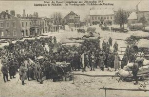
Nach der Russenvertreibung aus Ostpreußen 1915 - Marktplatz in Pillkallen
Rentenkataster des Kreises Pillkallen: Kirchspiel Pillkallen
Prästationstabellen des Kreises Pillkallen: Kirchspiel Pillkallen
Rentenkataster des Kreises Pillkallen: Kirchspiel Pillkallen
Rentenkataster des Kreises Pillkallen: Kirchspiel Pillkallen
Prästationstabellen des Kreises Pillkallen: Kirchspiel Pillkallen
Prästationstabellen des Kreises Pillkallen: Kirchspiel Pillkallen
Finanzamt Pillkallen
Zuhause in Pillkallen : Dorfgeschichten erlebt in Ostpreußen
Zuhause in Pillkallen : Dorfgeschichten erlebt in Ostpreussen
Blatt 196 Pillkallen, neu: 12101 Schloßberg i. Ostpreußen
Blatt 196 Pillkallen, neu: 12101 Schloßberg i. Ostpreußen
Nach der Russenvertreibung aus Ostpreußen 1915 - Marktplatz in Pillkallen
Rentenkataster des Kreises Pillkallen: Kirchspiel Pillkallen
Prästationstabellen des Kreises Pillkallen: Kirchspiel Pillkallen
Rentenkataster des Kreises Pillkallen: Kirchspiel Pillkallen
Rentenkataster des Kreises Pillkallen: Kirchspiel Pillkallen
Prästationstabellen des Kreises Pillkallen: Kirchspiel Pillkallen
Prästationstabellen des Kreises Pillkallen: Kirchspiel Pillkallen