Karten / Pläne
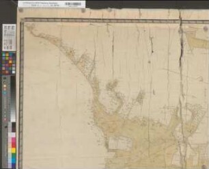
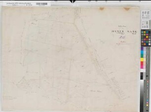
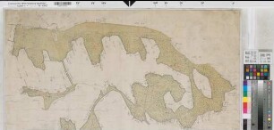
Billerbeck (Billerbeck), Teilung der Ostheller Mark, Bl. 2 Brouillonkarte
- Reference number
-
W 051, 38746
- Dimensions
-
Höhe: 53, Breite: 85, Maßstab: 1:3000
- Context
-
Karten A (Allgemein) >> 11. Landesamt für Agrarordnung >> 11.65. Billerbeck (Billerbeck), Teilung der Ostheller Mark
- Holding
-
W 051 Karten A (Allgemein)
- Date of creation
-
1806
- Other object pages
- Delivered via
- Last update
-
16.03.0004, 2:15 PM CET
Data provider
This object is provided by:
Landesarchiv Nordrhein-Westfalen. Abteilung Westfalen. If you have any questions about the object, please contact the data provider.
Landesarchiv Nordrhein-Westfalen. Abteilung Westfalen. If you have any questions about the object, please contact the data provider.
Object type
- Karten / Pläne
Time of origin
- 1806
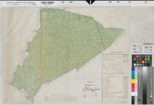
Other Objects (12)
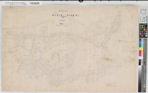
Billerbeck (Billerbeck), Teilung der Ostheller Mark, Bl. 1 Brouillonkarte
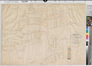
Billerbeck (Billerbeck), Teilung der Ostheller Mark, Bl. 3 Brouillonkarte
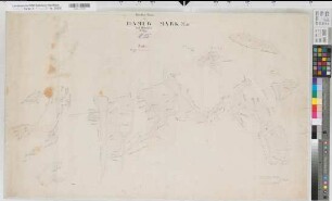
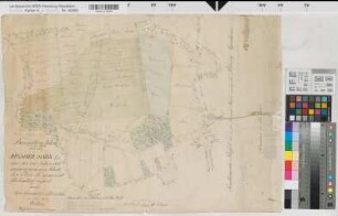
Billerbeck (Billerbeck), Teilung der Hämmer Mark, Brouillonkarte Bl.4
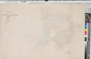
Billerbeck (Billerbeck), Teilung der Hämmer Mark, Brouillonkarte Bl.3
Billerbeck (Billerbeck), Teilung der Hämmer Mark, Brouillonkarte Bl.2
Billerbeck (Billerbeck), Teilung der Hämmer Mark, Brouillonkarte Bl.1
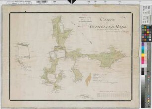
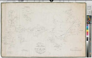
Billerbeck (Billerbeck), Teilung des Lütkenfeldes, Brouillonkarte
Billerbeck (Billerbeck), Teilung des Südfelds, Brouillonkarte
Billerbeck (Billerbeck), Teilung der Westheller und Gerlever Mark, Brouillonkarte Westheller Mark
Billerbeck (Billerbeck), Teilung der Westheller und Gerlever Mark, Brouillonkarte Gerlever Mark
Beerlage (Billerbeck), Teilung der Risauer Mark, Brouillonkarte
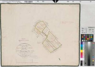
Billerbeck (Billerbeck), Teilung der Ostheller Mark, Bl. 3 Reinkarte
Billerbeck (Billerbeck), Teilung der Ostheller Mark, Bl. 1 Brouillonkarte
Billerbeck (Billerbeck), Teilung der Ostheller Mark, Bl. 3 Brouillonkarte
Billerbeck (Billerbeck), Teilung der Hämmer Mark, Brouillonkarte Bl.4
Billerbeck (Billerbeck), Teilung der Hämmer Mark, Brouillonkarte Bl.3
Billerbeck (Billerbeck), Teilung der Hämmer Mark, Brouillonkarte Bl.2
Billerbeck (Billerbeck), Teilung der Hämmer Mark, Brouillonkarte Bl.1
Billerbeck (Billerbeck), Teilung des Lütkenfeldes, Brouillonkarte
Billerbeck (Billerbeck), Teilung des Südfelds, Brouillonkarte
Billerbeck (Billerbeck), Teilung der Westheller und Gerlever Mark, Brouillonkarte Westheller Mark
Billerbeck (Billerbeck), Teilung der Westheller und Gerlever Mark, Brouillonkarte Gerlever Mark
Beerlage (Billerbeck), Teilung der Risauer Mark, Brouillonkarte