- Alternative title
-
Karte von Südosteuropa
- Location
-
Deutsches Historisches Museum, Berlin
- Inventory number
-
Do 74/17II
- Measurements
-
Höhe x Breite: 82 x 70 cm
- Material/Technique
-
Papier, gedruckt
- Subject (what)
-
Weltkrieg, 2.
- Event
-
Herstellung
- (where)
-
Deutschland [historisch: Deutsches Reich]
- (when)
-
1941
- Rights
-
Deutsches Historisches Museum
- Last update
-
24.03.2023, 9:31 AM CET
Data provider
This object is provided by:
Stiftung Deutsches Historisches Museum. If you have any questions about the object, please contact the data provider.
Stiftung Deutsches Historisches Museum. If you have any questions about the object, please contact the data provider.
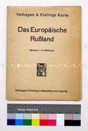
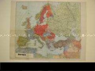
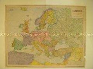
Object type
- Politisch-administrative Karte
Time of origin
- 1941
Other Objects (12)

Politisch-administrative Karte von Südosteuropa
Politisch-Administrative Karte Osteuropas
Politisch-administrative Karte von Osteuropa
Politisch-administrative Karte von Europa
Politisch-administrative Karten von Europa
Politisch-administrative Karte von Europa
Politisch-administrative Karte von Polen
Politisch-Administrative Karte von Europa
Politisch-administrative Karte von Nordwestdeutschland
Politisch-administrative Karte des Mittelmeerraums
Politisch-administrative Karte des Mittelmeerraumes
Politisch-administrative Karte des Ruhrgebietes
Politisch-administrative Karte von Südosteuropa
Politisch-Administrative Karte Osteuropas
Politisch-administrative Karte von Osteuropa
Politisch-administrative Karte von Europa
Politisch-administrative Karten von Europa
Politisch-administrative Karte von Europa
Politisch-administrative Karte von Polen
Politisch-Administrative Karte von Europa
Politisch-administrative Karte von Nordwestdeutschland
Politisch-administrative Karte des Mittelmeerraums
Politisch-administrative Karte des Mittelmeerraumes