Archivale
Stadtplan Duisburg, südlicher Teil, englischer Kriegsplan (Fotokopie). 1:12500
- Reference number
-
59, 309.4
- Context
-
Karten des Vermessungs- und Katasteramtes >> 3. Stadtpläne >> 309. Pausfähige Übersichtskarten der Stadt Duisburg
- Holding
-
59 Karten des Vermessungs- und Katasteramtes
- Date of creation
-
1945
- Other object pages
- Delivered via
- Last update
-
24.06.2025, 2:07 PM CEST
Data provider
This object is provided by:
Stadtarchiv Duisburg. If you have any questions about the object, please contact the data provider.
Stadtarchiv Duisburg. If you have any questions about the object, please contact the data provider.
Object type
- Archivale
Time of origin
- 1945
Other Objects (12)

Stadtplan Duisburg, nördlicher Teil, englischer Kriegsplan (Fotokopie). 1:12500
Stadtplan Duisburg, mittlerer Teil, englischer Kriegsplan (Fotokopie). 1:12500
Amtlicher Stadtplan Tübingen 1:12500
Amtlicher Stadtplan Tübingen 1:12500
Karte des Truppenübungsplatzes (1:12.500)
Karte des Truppenübungsplatzes (1:12.500)
Karte des Exerzierplatzes (1:12.500)
Karte des Truppenübungsplatzes (1:12.500)
Karte des Truppenübungsplatzes (1:12.500)
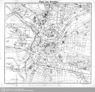
Plan von Dresden : 1:12500
Karte des Truppenübungsplatzes (1:12.500)
Karte des Truppenübungsplatzes (1:12.500)
Stadtplan Duisburg, nördlicher Teil, englischer Kriegsplan (Fotokopie). 1:12500
Stadtplan Duisburg, mittlerer Teil, englischer Kriegsplan (Fotokopie). 1:12500
Amtlicher Stadtplan Tübingen 1:12500
Amtlicher Stadtplan Tübingen 1:12500
Karte des Truppenübungsplatzes (1:12.500)
Karte des Truppenübungsplatzes (1:12.500)
Karte des Exerzierplatzes (1:12.500)
Karte des Truppenübungsplatzes (1:12.500)
Karte des Truppenübungsplatzes (1:12.500)
Plan von Dresden : 1:12500
Karte des Truppenübungsplatzes (1:12.500)