Verzeichnung
Plan der Stadt Cloppenburg (Straßen und Wohnplatzverzeichnis, 2 Exemplare, Farbdruck) Maßstab: 1:10.000 Hersteller/Herausgeber: Katasteramt Cloppenburg/Vermessungs- und Katasterverwaltung Oldenburg
- Reference number
-
NLA OL, K-ZE, Best. 298 Z Nr. 1493/1
- Further information
-
Identifikation: Band:
Index-Gruppe: Institution: Katasteramt Cloppenburg
Index-Gruppe: Institution: Vermessungs- und Katasterverwaltung Oldenburg
- Context
-
Zentraler Kartenbestand Oldenburg >> 5 Bezirksregierung Weser-Ems >> 5.3 Landkreis Cloppenburg >> 5.3.3 Größere Gebietsteile >> 5.3.3.4 Stadt Cloppenburg
- Holding
-
NLA OL, K-ZE Zentraler Kartenbestand Oldenburg
- Indexentry place
-
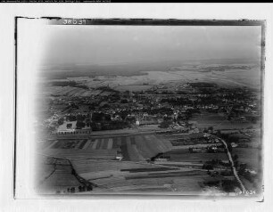
Cloppenburg, Karte
- Date of creation
-
- 1965
- Other object pages
- Last update
-
16.06.2025, 11:09 AM CEST
Data provider
This object is provided by:
Niedersächsisches Landesarchiv. If you have any questions about the object, please contact the data provider.
Niedersächsisches Landesarchiv. If you have any questions about the object, please contact the data provider.
Object type
- Verzeichnung
Time of origin
- - 1965
Other Objects (12)

Gemeindekarte Cloppenburg Druck, Vermessungs- und Katasterverwaltung Oldenburg Maßstab: 1:10.000
Plan der Stadt Cloppenburg (3 Exemplare) Maßstab: 1:10.000 Hersteller: Katasteramt Cloppenburg Herausgeber: Vermessungs- und Katasterverwaltung Oldenburg Druck/Verlag: Niedersächsisches Landesverwaltungsamt -Landesvermessung-
Karte des Landkreises Cloppenburg (nach der Verwaltungsreform, Lichtpause) Maßstab: 1:50.000 Herausgeber: Vermessungs- und Katasterverwaltung Oldenburg
Vermessungs- & Katasterverwaltung
Ansichten vom Katasteramt in Cloppenburg Maßstab: 1:100
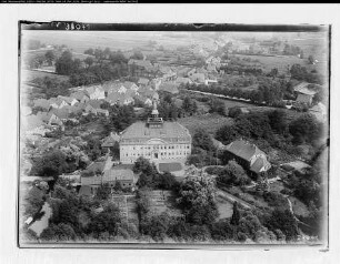
Cloppenburg
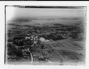
Cloppenburg
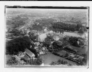
Cloppenburg
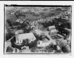
Cloppenburg
Cloppenburg
Cloppenburg
Cloppenburg
Gemeindekarte Cloppenburg Druck, Vermessungs- und Katasterverwaltung Oldenburg Maßstab: 1:10.000
Plan der Stadt Cloppenburg (3 Exemplare) Maßstab: 1:10.000 Hersteller: Katasteramt Cloppenburg Herausgeber: Vermessungs- und Katasterverwaltung Oldenburg Druck/Verlag: Niedersächsisches Landesverwaltungsamt -Landesvermessung-
Karte des Landkreises Cloppenburg (nach der Verwaltungsreform, Lichtpause) Maßstab: 1:50.000 Herausgeber: Vermessungs- und Katasterverwaltung Oldenburg
Vermessungs- & Katasterverwaltung
Ansichten vom Katasteramt in Cloppenburg Maßstab: 1:100
Cloppenburg
Cloppenburg
Cloppenburg
Cloppenburg
Cloppenburg
Cloppenburg
Cloppenburg
Gemeindekarte Cloppenburg Druck, Vermessungs- und Katasterverwaltung Oldenburg Maßstab: 1:10.000
Plan der Stadt Cloppenburg (3 Exemplare) Maßstab: 1:10.000 Hersteller: Katasteramt Cloppenburg Herausgeber: Vermessungs- und Katasterverwaltung Oldenburg Druck/Verlag: Niedersächsisches Landesverwaltungsamt -Landesvermessung-
Karte des Landkreises Cloppenburg (nach der Verwaltungsreform, Lichtpause) Maßstab: 1:50.000 Herausgeber: Vermessungs- und Katasterverwaltung Oldenburg
Vermessungs- & Katasterverwaltung
Ansichten vom Katasteramt in Cloppenburg Maßstab: 1:100
Cloppenburg
Cloppenburg
Cloppenburg
Cloppenburg
Cloppenburg
Cloppenburg