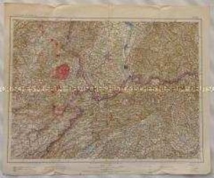
Militärkarte
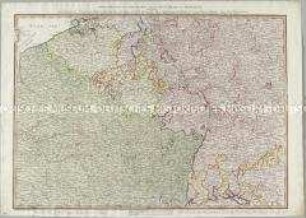
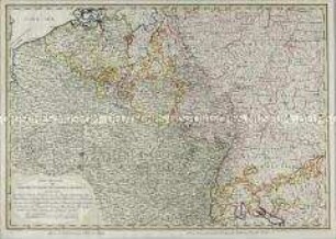
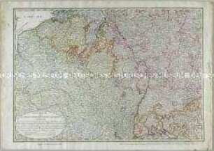
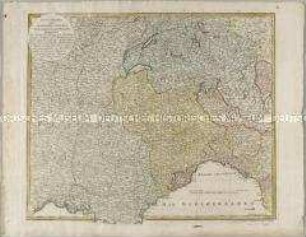
Kriegsschauplatz oder Graenzkarte zwischen Deutschland u. Franckreich
- Alternative title
-
Kriegsschauplatz / oder / Graenzkarte zwischen Deutschland u. Franckreich / Enthaltend
- Location
-
Deutsches Historisches Museum, Berlin
- Inventory number
-
Do 2006/1020
- Measurements
-
Höhe x Breite: 58 x 72 cm (Blatt)
Höhe x Breite: 44,7 x 55 cm (Karte)
Höhe x Breite: 49 x 60 cm (Platte)
- Material/Technique
-
Papier, Kupferstich, grenzkoloriert
- Classification
-
Kartografie (Gattung)
- Subject (what)
-
Deutschland
Frankreich
Belgien
- Event
-
Herstellung
- (who)
-
Kartograf, Verleger: Johann Walch
Stecher, Verleger: Johann Martin Will
- (where)
-
Augsburg, Deutschland
- (when)
-
um 1800
- Rights
-
Deutsches Historisches Museum
- Last update
-
24.03.2023, 9:31 AM CET
Data provider
This object is provided by:
Stiftung Deutsches Historisches Museum. If you have any questions about the object, please contact the data provider.
Stiftung Deutsches Historisches Museum. If you have any questions about the object, please contact the data provider.
Object type
- Militärkarte
Associated
- Kartograf, Verleger: Johann Walch
- Stecher, Verleger: Johann Martin Will
Time of origin
- um 1800
Other Objects (12)
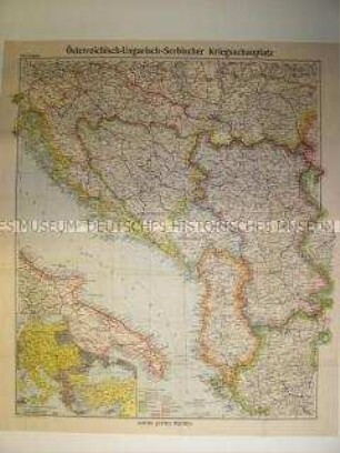
Militärstrategische Karte vom Kriegsschauplatz Südosteuropa (Ungarn, Serbien, Bosnien, Albanien)
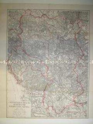
Militärstrategische Karte vom Kriegsschauplatz auf dem Balkan (Serbien, Montenegro, Albanien, Bulgarien)
Kriegstheater, oder Graenzkarte zwischen Deutschland und Frankreich
Kriegstheater, oder Graenzkarte zwischen Deutschland und Frankreich
Kriegstheater, oder Graenzkarte zwischen Deutschland und Frankreich
Kriegstheater oder Graenzkarte zwischen Frankreich und Italien
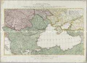
Kriegstheater oder Graenzkarte Oesterreichs, Russlands, und der Türkey

Karte der Bundesrepublik Deutschland mit den Stützpunkten der US Army im Juni 1990
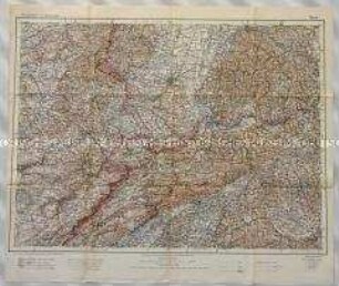
Topographische Karte des Dreiländerecks Deutschland-Frankreich-Schweiz nördlich des Juragebirges mit Belfort, Mühlhausen, Freiburg und Basel, südlich bis Luzern und La-Chaux-de-Fonds
Topographische Karte des Dreiländerecks Deutschland-Frankreich-Schweiz nördlich des Juragebirges mit Belfort, Mühlhausen, Freiburg und Basel, südlich bis Luzern und La-Chaux-de-Fonds
Topographische Karte der Gegend östlich von Oberglogau zwischen Krappitz und Cosel an der Oder sowie Leschnitz im Königreich Preußen
Topographische Karte des Truppenübungsplatzes Zeithain in Sachsen mit dem Artillerieschießplatz Gohrisch Heide und Umgebung
Militärstrategische Karte vom Kriegsschauplatz Südosteuropa (Ungarn, Serbien, Bosnien, Albanien)
Militärstrategische Karte vom Kriegsschauplatz auf dem Balkan (Serbien, Montenegro, Albanien, Bulgarien)
Kriegstheater, oder Graenzkarte zwischen Deutschland und Frankreich
Kriegstheater, oder Graenzkarte zwischen Deutschland und Frankreich
Kriegstheater, oder Graenzkarte zwischen Deutschland und Frankreich
Kriegstheater oder Graenzkarte zwischen Frankreich und Italien
Kriegstheater oder Graenzkarte Oesterreichs, Russlands, und der Türkey
Karte der Bundesrepublik Deutschland mit den Stützpunkten der US Army im Juni 1990
Topographische Karte des Dreiländerecks Deutschland-Frankreich-Schweiz nördlich des Juragebirges mit Belfort, Mühlhausen, Freiburg und Basel, südlich bis Luzern und La-Chaux-de-Fonds
Topographische Karte des Dreiländerecks Deutschland-Frankreich-Schweiz nördlich des Juragebirges mit Belfort, Mühlhausen, Freiburg und Basel, südlich bis Luzern und La-Chaux-de-Fonds
Topographische Karte der Gegend östlich von Oberglogau zwischen Krappitz und Cosel an der Oder sowie Leschnitz im Königreich Preußen