- Location
-
Deutsches Historisches Museum, Berlin
- Inventory number
-
Do2 2004/720
- Measurements
-
Höhe x Breite: 92 x 50 cm
- Material/Technique
-
Papier : Leinwand, gedruckt, aufgezogen
- Classification
-
Kartografie (Gattung)
- Subject (what)
-
Topographie
- Event
-
Herstellung
- (where)
-
Berlin ?, Deutschland [historisch: Deutsches Reich]
- (when)
-
1920
- Rights
-
Deutsches Historisches Museum
- Last update
-
24.03.2023, 9:29 AM CET
Data provider
This object is provided by:
Stiftung Deutsches Historisches Museum. If you have any questions about the object, please contact the data provider.
Stiftung Deutsches Historisches Museum. If you have any questions about the object, please contact the data provider.
Object type
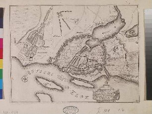
- Stadtplan
Time of origin
- 1920
Other Objects (12)
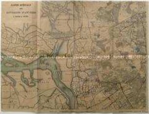
Sechsteilige topografische Karte von Antwerpen und Umgebung vom Beginn des Ersten Weltkrieges

Brunn's Plan von München : mit 2 westlichen Anschlussblättern: Bl. I Pasing - Aubing, Bl. II Grosshadern - Gräfelfing - Planegg
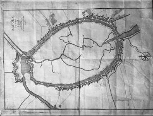
Topografische Übersicht von Brügge mit den vier Stadttoren
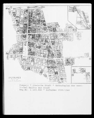
Pompeji, Plan der römischen Stadt: westliche Hälfte
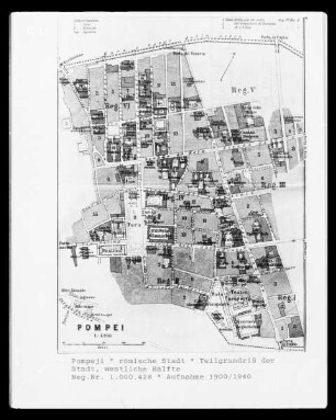
Pompeji, Plan der römischen Stadt: westliche Hälfte
Karte von Stettin

Karte von Kiel
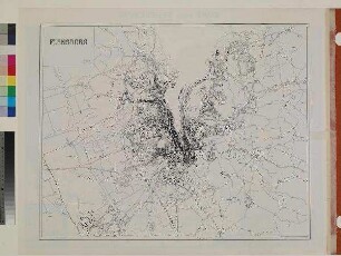
Karte von Flensburg
Karte von Altona
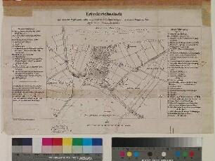
Karte von Friedrichstadt

Karte von Lauenburg
Karte von Hamburg
Sechsteilige topografische Karte von Antwerpen und Umgebung vom Beginn des Ersten Weltkrieges
Brunn's Plan von München : mit 2 westlichen Anschlussblättern: Bl. I Pasing - Aubing, Bl. II Grosshadern - Gräfelfing - Planegg
Topografische Übersicht von Brügge mit den vier Stadttoren
Pompeji, Plan der römischen Stadt: westliche Hälfte
Pompeji, Plan der römischen Stadt: westliche Hälfte
Karte von Stettin
Karte von Kiel
Karte von Flensburg
Karte von Altona
Karte von Friedrichstadt
Karte von Lauenburg