Regionalkarte
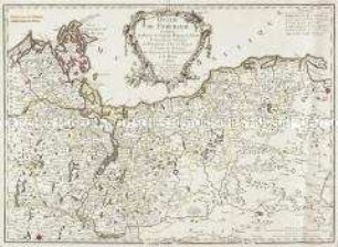
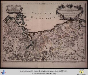
Grand Atlas . Bl 9 (Pommern, Polen, Preussen): Contenant un reste de Pomeranie et une Partie de la Pologne Prussiene savoir les Territoires de Dirschau, Schlochow, Tuchel, Schwetz et bu Palatinat de Kulm et et.
- Alternative title
-
CARTE TOPOGRAPHIQUE D'ALLEMAGNE / Contenant un reste de POMERANIE et une PARTIE de la POLOGNE PRUSSIENE savoir les Territoires de DIRSCHAU, SCHLOCHOW, TUCHEL, SCHWETZ et bu PALATINAT / de KULM et et.
- Location
-
Deutsches Historisches Museum, Berlin
- Inventory number
-
Do 2006/1059.9
- Measurements
-
Höhe x Breite: 56,5 x 78 cm, Höhe: 56,5 cm, Breite: 78 cm, Tiefe: 3 cm (Atlas)
Höhe x Breite: 56,5 x 78 cm (Blatt)
Höhe x Breite: 52 x 68 cm (Platte)
Höhe x Breite: 46 x 59 cm (Karte)
- Material/Technique
-
Papier, Kupferstich, koloriert, gebunden |Fadenheftung
- Classification
-
Kartografie (Gattung)
- Subject (what)
-
Deutschland
- Event
-
Herstellung
- (who)
-
Verleger, Militärkartograph: Johann Wilhelm Abraham Jaeger
Stecher: Johann Christian Berndt
- (where)
-
Frankfurt (Main) [historisch: Frankfurt, Reichsstadt], Deutschland
- (when)
-
um 1782
- Rights
-
Deutsches Historisches Museum
- Last update
-
24.03.2023, 9:30 AM CET
Data provider
This object is provided by:
Stiftung Deutsches Historisches Museum. If you have any questions about the object, please contact the data provider.
Stiftung Deutsches Historisches Museum. If you have any questions about the object, please contact the data provider.
Object type
- Regionalkarte
Associated
- Verleger, Militärkartograph: Johann Wilhelm Abraham Jaeger
- Stecher: Johann Christian Berndt
Time of origin
- um 1782
Other Objects (12)

Voyages, De Brandebourg, Poméranie, Prusse, Curlande, Russie Et Pologne

Coûtume de Bretagne, et usances particulières de quelques villes et territoires de la mesme province
Duché de Pomeranie
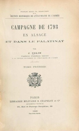
Campagne de 1793 en Alsace et dans le Palatinat
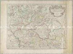
Les Archeveschés et Eslectorats de Mayence et de Treves, Le Palatinat et Eslectorat du Rhein, le Duché de Wirtenberg
III. L'assistance sociale organisée par la population dans les territoires occupés par les Allemandes. L'aide de la Grande- Pologne et de la Poméranie polonaise
Le Duché de Pomeranie
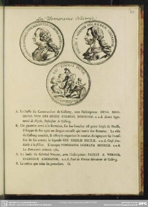
La Pomeranie de´livrée
![[Duche de Wurtenberg, Franconie, Alsace, Palatinat et Eslectorat du Rhein]](https://iiif.deutsche-digitale-bibliothek.de/image/2/b7592840-6de0-4af2-a369-b546e04b6d89/full/!306,450/0/default.jpg)
[Duche de Wurtenberg, Franconie, Alsace, Palatinat et Eslectorat du Rhein]
Parties Des Archeveschés Et Eslectorats de Mayence, De Treves; Du Palatinat et Eslectorat Du Rhein &c.
Les nappes de recouvrement des Alpes occidentales et les territoires environnant

Les nappes de recouvrement des Alpes occidentales et les territoires environnant
Voyages, De Brandebourg, Poméranie, Prusse, Curlande, Russie Et Pologne
Coûtume de Bretagne, et usances particulières de quelques villes et territoires de la mesme province
Duché de Pomeranie
Campagne de 1793 en Alsace et dans le Palatinat
Les Archeveschés et Eslectorats de Mayence et de Treves, Le Palatinat et Eslectorat du Rhein, le Duché de Wirtenberg
III. L'assistance sociale organisée par la population dans les territoires occupés par les Allemandes. L'aide de la Grande- Pologne et de la Poméranie polonaise
Le Duché de Pomeranie
La Pomeranie de´livrée
[Duche de Wurtenberg, Franconie, Alsace, Palatinat et Eslectorat du Rhein]
Parties Des Archeveschés Et Eslectorats de Mayence, De Treves; Du Palatinat et Eslectorat Du Rhein &c.
Les nappes de recouvrement des Alpes occidentales et les territoires environnant
Les nappes de recouvrement des Alpes occidentales et les territoires environnant
Voyages, De Brandebourg, Poméranie, Prusse, Curlande, Russie Et Pologne
Coûtume de Bretagne, et usances particulières de quelques villes et territoires de la mesme province
Duché de Pomeranie
Campagne de 1793 en Alsace et dans le Palatinat
Les Archeveschés et Eslectorats de Mayence et de Treves, Le Palatinat et Eslectorat du Rhein, le Duché de Wirtenberg
III. L'assistance sociale organisée par la population dans les territoires occupés par les Allemandes. L'aide de la Grande- Pologne et de la Poméranie polonaise
Le Duché de Pomeranie
La Pomeranie de´livrée
[Duche de Wurtenberg, Franconie, Alsace, Palatinat et Eslectorat du Rhein]
Parties Des Archeveschés Et Eslectorats de Mayence, De Treves; Du Palatinat et Eslectorat Du Rhein &c.
Les nappes de recouvrement des Alpes occidentales et les territoires environnant