Karte
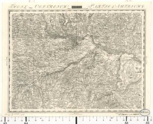
Theil von Oestreich (Neustadt) [Wiener Neustadt] [Topographisch-militairische Charte von Teutschland]
- Location
-
Leibniz-Institut für Länderkunde e.V., Leipzig
- Other number(s)
-
HK 0621 - 172 (Signatur)
- Subject (what)
-
Altkarte
Topographische Karte
Mitteleuropa
Deutschland
Österreich
- Event
-
Veröffentlichung
- (who)
-
Geographisches Institut (Verlag)
- (where)
-
Weimar
- Rights
-
Leibniz-Institut für Länderkunde e.V.
- Last update
-
15.05.2025, 12:43 PM CEST
Data provider
This object is provided by:
Leibniz-Institut für Länderkunde e. V.. If you have any questions about the object, please contact the data provider.
Leibniz-Institut für Länderkunde e. V.. If you have any questions about the object, please contact the data provider.
Object type
- Karte
Associated
- Geographisches Institut (Verlag)
Other Objects (12)
![Theil von Oestreich (Wien) [Topographisch-militairische Charte von Teutschland]](https://iiif.deutsche-digitale-bibliothek.de/image/2/80d60ad9-156d-4874-9765-c54af9be7e7d/full/!306,450/0/default.jpg)
Theil von Oestreich (Wien) [Topographisch-militairische Charte von Teutschland]
![Theil von Oestreich (Linz) [Topographisch-militairische Charte von Teutschland]](https://iiif.deutsche-digitale-bibliothek.de/image/2/da1ece3b-6d5d-4d5c-a592-ce6a039e5f0f/full/!306,450/0/default.jpg)
Theil von Oestreich (Linz) [Topographisch-militairische Charte von Teutschland]
![Theil von Oestreich (Zistersdorf) [Topographisch-militairische Charte von Teutschland]](https://iiif.deutsche-digitale-bibliothek.de/image/2/f020156c-7395-47f1-854e-1d90f30aadb8/full/!306,450/0/default.jpg)
Theil von Oestreich (Zistersdorf) [Topographisch-militairische Charte von Teutschland]
![Theil von Oestreich (Zwettl) [Topographisch-militairische Charte von Teutschland]](https://iiif.deutsche-digitale-bibliothek.de/image/2/eb45d36b-384d-46be-960f-11ef78f38e3f/full/!306,450/0/default.jpg)
Theil von Oestreich (Zwettl) [Topographisch-militairische Charte von Teutschland]
![Theil von Oestreich (Ips) [Ybbs] [Topographisch-militairische Charte von Teutschland]](https://iiif.deutsche-digitale-bibliothek.de/image/2/683c6887-1506-47be-a145-8f2e2b9bccf7/full/!306,450/0/default.jpg)
Theil von Oestreich (Ips) [Ybbs] [Topographisch-militairische Charte von Teutschland]
![Theil von Oestreich (Eisenertz) [Eisenerz] [Topographisch-militairische Charte von Teutschland]](https://iiif.deutsche-digitale-bibliothek.de/image/2/c6b4e8b5-2b05-414c-9700-e261efa0547b/full/!306,450/0/default.jpg)
Theil von Oestreich (Eisenertz) [Eisenerz] [Topographisch-militairische Charte von Teutschland]
![Theil von Baiern (Neustadt) [Topographisch-militairische Charte von Teutschland]](https://iiif.deutsche-digitale-bibliothek.de/image/2/7dfa00f3-1701-4601-9be4-d25ff692cdb8/full/!306,450/0/default.jpg)
Theil von Baiern (Neustadt) [Topographisch-militairische Charte von Teutschland]
![Theil von Oestreich (Wind. Gastein) [Windischgarsten] [Topographisch-militairische Charte von Teutschland]](https://iiif.deutsche-digitale-bibliothek.de/image/2/5b97aaba-ef43-4281-a030-a4c1b3de7456/full/!306,450/0/default.jpg)
Theil von Oestreich (Wind. Gastein) [Windischgarsten] [Topographisch-militairische Charte von Teutschland]
![Theil von Oestreich (Znaym) [Znaim Znojmo] [Topographisch-militairische Charte von Teutschland]](https://iiif.deutsche-digitale-bibliothek.de/image/2/61a4d7b0-0704-473d-a9e2-1927e84f4797/full/!306,450/0/default.jpg)
Theil von Oestreich (Znaym) [Znaim Znojmo] [Topographisch-militairische Charte von Teutschland]
![Theil von Oestreich (Presburg) [Preßburg, Bratislava] [Topographisch-militairische Charte von Teutschland]](https://iiif.deutsche-digitale-bibliothek.de/image/2/8575cf10-e779-4669-b386-da01682e0211/full/!306,450/0/default.jpg)
Theil von Oestreich (Presburg) [Preßburg, Bratislava] [Topographisch-militairische Charte von Teutschland]
Topographisch-militairische Charte von Teutschland : in 204 Blättern, 159. Theil von Oestreich
![(Zarnowiek) [Żarnowiec] [Topographisch-militairische Charte von Teutschland]](https://iiif.deutsche-digitale-bibliothek.de/image/2/88739172-86f5-4bd8-a5e2-c3047e50a9d3/full/!306,450/0/default.jpg)
(Zarnowiek) [Żarnowiec] [Topographisch-militairische Charte von Teutschland]
Theil von Oestreich (Wien) [Topographisch-militairische Charte von Teutschland]
Theil von Oestreich (Linz) [Topographisch-militairische Charte von Teutschland]
Theil von Oestreich (Zistersdorf) [Topographisch-militairische Charte von Teutschland]
Theil von Oestreich (Zwettl) [Topographisch-militairische Charte von Teutschland]
Theil von Oestreich (Ips) [Ybbs] [Topographisch-militairische Charte von Teutschland]
Theil von Oestreich (Eisenertz) [Eisenerz] [Topographisch-militairische Charte von Teutschland]
Theil von Baiern (Neustadt) [Topographisch-militairische Charte von Teutschland]
Theil von Oestreich (Wind. Gastein) [Windischgarsten] [Topographisch-militairische Charte von Teutschland]
Theil von Oestreich (Znaym) [Znaim Znojmo] [Topographisch-militairische Charte von Teutschland]
Theil von Oestreich (Presburg) [Preßburg, Bratislava] [Topographisch-militairische Charte von Teutschland]
Topographisch-militairische Charte von Teutschland : in 204 Blättern, 159. Theil von Oestreich