Verzeichnung
Karte (östlicher Teil) von Frankreich (administrative Zuordnung, siehe 298 Z Nr. 1780) Maßstab: 1:2.000.000 Vermesser/Zeichner: Lapie
- Reference number
-
NLA OL, K-ZE, Best. 298 Z Nr. 1790
- Further information
-
Identifikation: Band:
- Context
-
Zentraler Kartenbestand Oldenburg >> 8 Europa
- Holding
-
NLA OL, K-ZE Zentraler Kartenbestand Oldenburg
- Indexentry person
-
Lapie, Geograph/Zeichner
- Indexentry place
-
Frankreich, Staat, Karte
- Date of creation
-
- 1850
- Other object pages
- Last update
-
16.06.2025, 11:08 AM CEST
Data provider
This object is provided by:
Niedersächsisches Landesarchiv. If you have any questions about the object, please contact the data provider.
Niedersächsisches Landesarchiv. If you have any questions about the object, please contact the data provider.
Object type
- Verzeichnung
Time of origin
- - 1850
Other Objects (12)
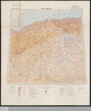
Nord-Algerien: Übersichtskarte 1:2000000

Atlas Europa : 1:2000000, 1:3500000
Mechanische Rüstungsindustrie in Schweden.- Standortkarte (1:2.000.000)
Generalkarte der preußischen Monarchie (Königreich Preußen) Maßstab: ca 1:2.000.000 Vermesser/Zeichner: Christoph Fembo
Karte (nördlicher Teil) von Frankreich Maßstab: ca 1:2.000.000 Vermesser/Zeichner: G. E. F. Seidel
Militärgeographische Angaben über Algerien (Entwurf): Straßenkarte 1:2.000.000
Militärgeographische Angaben über Iran (Entwurf): Übersichtskarte 1:2.000.000
Militärgeographische Angaben über Marokko (Entwurf): Übersichtskarte 1:2.000.000
Deutsche Reichsbahn - Übersichtskarte. 1:2.000.000. Deutsche Reichsbahngesellschaft (Bearbeiter)
Militärgeographische Angaben über die Türkei: Übersichtskarte 1:2.000.000
Militärgeographische Angaben über Iran (Vorläufiger Teilabdruck): Übersichtskarte 1:2.000.000
Militärgeographische Angaben über Ägypten (Entwurf): Übersichtskarte Ägypten 1:2.000.000
Nord-Algerien: Übersichtskarte 1:2000000
Atlas Europa : 1:2000000, 1:3500000
Mechanische Rüstungsindustrie in Schweden.- Standortkarte (1:2.000.000)
Generalkarte der preußischen Monarchie (Königreich Preußen) Maßstab: ca 1:2.000.000 Vermesser/Zeichner: Christoph Fembo
Karte (nördlicher Teil) von Frankreich Maßstab: ca 1:2.000.000 Vermesser/Zeichner: G. E. F. Seidel
Militärgeographische Angaben über Algerien (Entwurf): Straßenkarte 1:2.000.000
Militärgeographische Angaben über Iran (Entwurf): Übersichtskarte 1:2.000.000
Militärgeographische Angaben über Marokko (Entwurf): Übersichtskarte 1:2.000.000
Deutsche Reichsbahn - Übersichtskarte. 1:2.000.000. Deutsche Reichsbahngesellschaft (Bearbeiter)
Militärgeographische Angaben über die Türkei: Übersichtskarte 1:2.000.000
Militärgeographische Angaben über Iran (Vorläufiger Teilabdruck): Übersichtskarte 1:2.000.000