Grenzkarte
Nova Mappa Geographica Sueciae ac Gothiae Regna ut et Finlandiae Ducatum ac Lapponiam
- Alternative title
-
NOVA MAPPA GEOGRAPHICA / SUECIAE / AC GOTHIAE REGNA / ut et
- Location
-
Deutsches Historisches Museum, Berlin
- Inventory number
-
Do 2006/605
- Measurements
-
Höhe x Breite: 59 x 72,5 cm (Blatt)
Höhe x Breite: 47,8 x 55,3 cm (Karte)
Höhe x Breite: 50 x 58 cm (Platte)
- Material/Technique
-
Papier, koloriert, grenzkoloriert, Kupferstich
- Classification
-
Kartografie (Gattung)
- Subject (what)
-
Schweden
Finnland
Baltikum
- Event
-
Herstellung
- (who)
-
Stecher, Verleger, Geograph: Tobias Konrad Lotter
- (where)
-
Augsburg, Deutschland
- (when)
-
um 1760
- Rights
-
Deutsches Historisches Museum
- Last update
-
24.03.2023, 9:27 AM CET
Data provider
This object is provided by:
Stiftung Deutsches Historisches Museum. If you have any questions about the object, please contact the data provider.
Stiftung Deutsches Historisches Museum. If you have any questions about the object, please contact the data provider.
Object type
- Grenzkarte
Associated
- Stecher, Verleger, Geograph: Tobias Konrad Lotter
Time of origin
- um 1760
Other Objects (12)
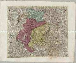
Nova Mappa Archiducatus Austriae Superioris

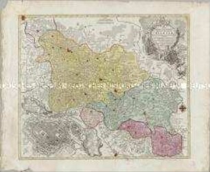
Mappa Circuli Rhenani Superioris (O), M ca. 1 : 470 000
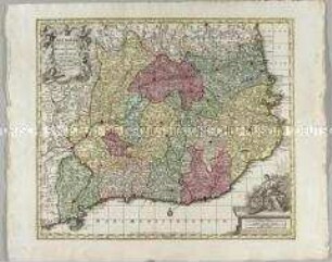
Nova Mappa Geographica Totius Ducatus Silesiae. Mit einem Stadtplan: Prospectus Vratislaviae
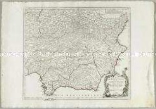
Cataloniae Principatus et Ruscinonis ac Cerretaniae Comitatuum
Europa. Christiani Orbis Domina, In Sua Imperia, Regna Et Status exacte divisa per Johan. Bapt. Homann
Fränkischer Reichskreis: Circuli Franconiae Pars Orientalis Et Potior novissime delineata quam Illustrißimis Generosißismis ac Excellentißimis Dn. Dn. Totius Circ. Francon. Legatis pro Salute publ. Norimbergae congregatis Dominis suis Gratiosis humillime D. D. D. Io. Bapt. Homann
Partie Meridionale des Etats de Castille
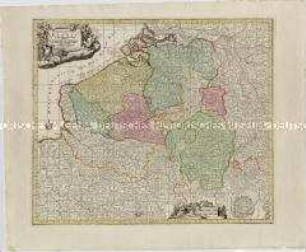
Germaniae Inferioris sive Belgii. Mit einem Fortifikationsplan: Ostende
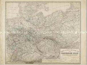
Nord und West-Deutschland der Preussische Staat und die übrigen Zollvereinsstaaten
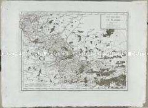
Atlas Nouveau: Gouvernement de Flandre
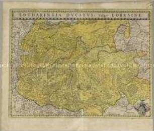
Lotharingia Ducatus

Deutschland vom Major C. F. Hammer. Nürnberg bey Friedrich Campe
Nova Mappa Archiducatus Austriae Superioris
Mappa Circuli Rhenani Superioris (O), M ca. 1 : 470 000
Nova Mappa Geographica Totius Ducatus Silesiae. Mit einem Stadtplan: Prospectus Vratislaviae
Cataloniae Principatus et Ruscinonis ac Cerretaniae Comitatuum
Europa. Christiani Orbis Domina, In Sua Imperia, Regna Et Status exacte divisa per Johan. Bapt. Homann
Fränkischer Reichskreis: Circuli Franconiae Pars Orientalis Et Potior novissime delineata quam Illustrißimis Generosißismis ac Excellentißimis Dn. Dn. Totius Circ. Francon. Legatis pro Salute publ. Norimbergae congregatis Dominis suis Gratiosis humillime D. D. D. Io. Bapt. Homann
Partie Meridionale des Etats de Castille
Germaniae Inferioris sive Belgii. Mit einem Fortifikationsplan: Ostende
Nord und West-Deutschland der Preussische Staat und die übrigen Zollvereinsstaaten
Atlas Nouveau: Gouvernement de Flandre
Lotharingia Ducatus