- Standort
-
München, Bayerische Staatsbibliothek -- Mapp. XI,564 q-13(1917)
- Maße
-
47 x 47 cm
- Umfang
-
1 Kt.
- Ausgabe
-
Corr. 2/80, 1899 umgrav. G. Höfer, 1917 umgrav. F. Brehm
- Sprache
-
Deutsch
- Anmerkungen
-
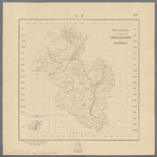
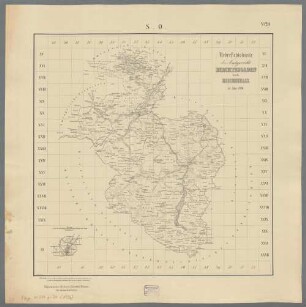
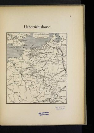
Mit Katasternetz (N.W. LXXXIV,4 - N.O. LXVII,14)
- Erschienen in
-
[Amtsgerichtsübersichtskarte von Bayern] ; 13
- Schlagwort
-
Geschichte 1917
Katastervermessung
Amtsgericht
Verwaltungsgrenze
Eschenbach i.d.OPf.
Auerbach i. d. OPf.
- Ereignis
-
Veröffentlichung
- (wo)
-
[München]
- (wer)
-
K.B. Landesvermessungsamt
- (wann)
-
1917
- Beteiligte Personen und Organisationen
- URN
-
urn:nbn:de:bvb:12-bsb00115899-6
- Letzte Aktualisierung
-
16.04.2025, 08:36 MESZ
Datenpartner
Dieses Objekt wird bereitgestellt von:
Bayerische Staatsbibliothek. Bei Fragen zum Objekt wenden Sie sich bitte an den Datenpartner.
Bayerische Staatsbibliothek. Bei Fragen zum Objekt wenden Sie sich bitte an den Datenpartner.
Objekttyp
- Karte
Beteiligte
- Obernetter, Johann
- Höfer, G.
- Brehm, F.
- K.B. Landesvermessungsamt
Entstanden
- 1917
Ähnliche Objekte (12)
Uebersichtskarte der Amtsgerichte Berchtesgaden und Reichenhall
Uebersichtskarte der Amtsgerichte Berchtesgaden und Reichenhall im Jahre 1896
![[Übersichtskarte]](https://iiif.deutsche-digitale-bibliothek.de/image/2/d7c25640-00e0-4d73-9c02-744ea4ae9b36/full/!306,450/0/default.jpg)
[Übersichtskarte]
![[Übersichtskarte]](https://iiif.deutsche-digitale-bibliothek.de/image/2/fd3bdbd3-ec5f-4a9a-8aef-fde186e384e2/full/!306,450/0/default.jpg)
[Übersichtskarte]

Übersichtskarte
![[Übersichtskarte]](https://iiif.deutsche-digitale-bibliothek.de/image/2/36060665-10d2-44e1-9d56-568dd1efb035/full/!306,450/0/default.jpg)
[Übersichtskarte]
Übersichtskarte
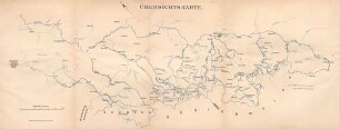
Übersichtskarte.
Uebersichtskarte
Übersichtskarte
Übersichtskarte
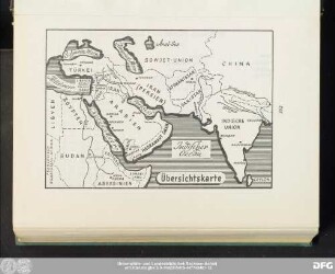
Balkan-Uebersichtskarte
Uebersichtskarte der Amtsgerichte Berchtesgaden und Reichenhall
Uebersichtskarte der Amtsgerichte Berchtesgaden und Reichenhall im Jahre 1896
[Übersichtskarte]
[Übersichtskarte]
Übersichtskarte
[Übersichtskarte]
Übersichtskarte
Übersichtskarte.
Uebersichtskarte
Übersichtskarte
Übersichtskarte