Altkarte
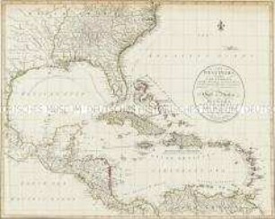
Colton's map of the United States of America, the British provinces, Mexico and the West Indies : showing the country from the Atlantic to the Pacific Ocean
Kurzbeschreibung: Einzelkarte
Kartographische Angaben: Nullmeridian Washington und Greenwich
- Location
-
Greifswald
- Collection
-
Kartensammlung des Instituts für Geographie und Geologie (Universität Greifswald)
- Inventory number
-
AltK/T10.00/1
- Measurements
-
135 x 150 cm
Maßstab [ca. 1:3,500,000]
- Material/Technique
-
Papierartig; geschnitten; auf Leinen gezogen
- Inscription/Labeling
-
Verantwortlichkeitsangabe: published by J.H. Colton
- Classification
-
Kartographie
- Subject (where)
-
New York
- Event
-
Herstellung
- (when)
-
1853
- Last update
-
25.03.2025, 9:46 AM CET
Data provider
This object is provided by:
Universität Greifswald. Kartensammlung des Instituts für Geographie und Geologie. If you have any questions about the object, please contact the data provider.
Universität Greifswald. Kartensammlung des Instituts für Geographie und Geologie. If you have any questions about the object, please contact the data provider.
Object type
- Altkarte
Time of origin
- 1853
Other Objects (12)

Into the indies

The East Indies
The west Indies
The West Indies

The west Indies
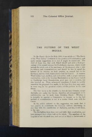
The Future of the West Indies

The Needs of the West Indies.
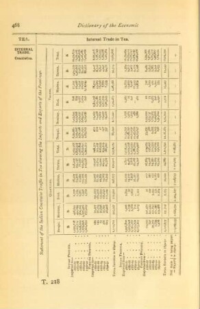
Statement of the Indian coastwise traffic in tea showing the imports and exports of the provinces
The British West Indies.
XXII.- THE WEST INDIES

The Consolidation of the British West Indies
The West Indies and the Spanish Main
Into the indies
The East Indies
The west Indies
The West Indies
The west Indies
The Future of the West Indies
The Needs of the West Indies.
Statement of the Indian coastwise traffic in tea showing the imports and exports of the provinces
The British West Indies.
XXII.- THE WEST INDIES
The Consolidation of the British West Indies