Verzeichnung
Ortsplan der Gemeinde Garrel (Grundlage: Deutsche Grundkarte 1:5000) Maßstab: 1:10.000 Herausgeber: Katasteramt Cloppenburg Herkunft: Acc. 43/83
- Reference number
-
NLA OL, K-ZE, Best. 298 Z Nr. 2637
- Further information
-
Identifikation: Band:
Index-Gruppe: Institution: Katasteramt Cloppenburg
- Context
-
Zentraler Kartenbestand Oldenburg >> 5 Bezirksregierung Weser-Ems >> 5.3 Landkreis Cloppenburg >> 5.3.5 Feldmarken, Stadt- und Ortspläne, Flurstücke >> 5.3.5.8 Gemeinde Garrel
- Holding
-
NLA OL, K-ZE Zentraler Kartenbestand Oldenburg
- Indexentry place
-
Garrel, Gemeinde, Karte
- Date of creation
-
- 1981
- Other object pages
- Last update
-
16.06.2025, 11:47 AM CEST
Data provider
This object is provided by:
Niedersächsisches Landesarchiv. If you have any questions about the object, please contact the data provider.
Niedersächsisches Landesarchiv. If you have any questions about the object, please contact the data provider.
Object type
- Verzeichnung
Time of origin
- - 1981
Other Objects (12)

Ortsplan der Gemeinde Garrel Herausgeber: Gemeinde Garrel Druck/Verlag: Goebecke&Isenburg, Braunschweig Herkunft: Acc. 43/83
Ortsplan von Beverbruch und Falkenburg (Landkreis Cloppenburg, Grundlage: Deutsche Grundkarte 1:5000) Maßstab: 1:10.000 Herausgeber.: Katasteramt Cloppenburg
Ortsplan von Varrelbusch und Nikolausdorf (Landkreis Cloppenburg, Grundlage: Deutsche Grundkarte 1:5000) Maßstab: 1:10.000 Herausgeber: Katasteramt Cloppenburg
Pfefferlehen zu Garrel im Amt Cloppenburg Lehnträger: Hillmann, Behrens
Thoben Erben zu Garrel im Kirchspiel Cloppenburg und Krapendorf
Ortsplan der Gemeinde Cappeln Herausgeber: Annonca-Verlagsgesellschaft, Lohne Herkunft: Acc. 40/83
Flugzeug D - EHPY (Jodel 150).- 15. März 1970 Garrel/Kreis Cloppenburg
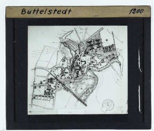
Stadtplan/Ortsplan : Ortsplan Butteklstedt
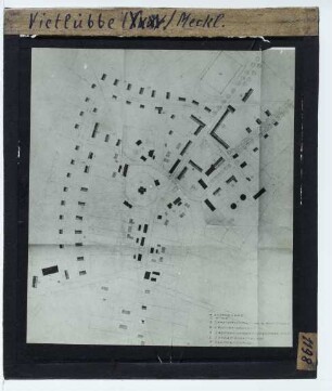
Stadtplan/Ortsplan : Ortsplan Vietlübbe
Ortsplan der Gemeinde Lindern (Oldenburg) Herausgeber: Annonca-Verlagsgesellschaft, Lohne Herkunft: Acc. 41/83
Garrel
Ortsplan
Ortsplan der Gemeinde Garrel Herausgeber: Gemeinde Garrel Druck/Verlag: Goebecke&Isenburg, Braunschweig Herkunft: Acc. 43/83
Ortsplan von Beverbruch und Falkenburg (Landkreis Cloppenburg, Grundlage: Deutsche Grundkarte 1:5000) Maßstab: 1:10.000 Herausgeber.: Katasteramt Cloppenburg
Ortsplan von Varrelbusch und Nikolausdorf (Landkreis Cloppenburg, Grundlage: Deutsche Grundkarte 1:5000) Maßstab: 1:10.000 Herausgeber: Katasteramt Cloppenburg
Pfefferlehen zu Garrel im Amt Cloppenburg Lehnträger: Hillmann, Behrens
Thoben Erben zu Garrel im Kirchspiel Cloppenburg und Krapendorf
Ortsplan der Gemeinde Cappeln Herausgeber: Annonca-Verlagsgesellschaft, Lohne Herkunft: Acc. 40/83
Flugzeug D - EHPY (Jodel 150).- 15. März 1970 Garrel/Kreis Cloppenburg
Stadtplan/Ortsplan : Ortsplan Butteklstedt
Stadtplan/Ortsplan : Ortsplan Vietlübbe
Ortsplan der Gemeinde Lindern (Oldenburg) Herausgeber: Annonca-Verlagsgesellschaft, Lohne Herkunft: Acc. 41/83
Garrel