Archivale
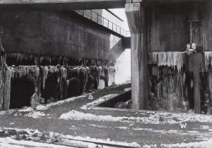
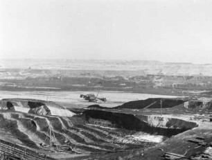
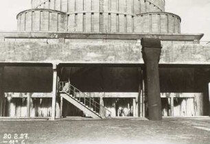
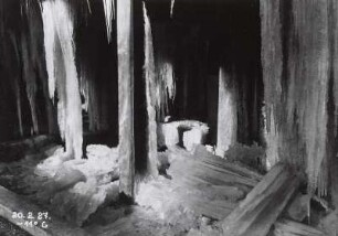
Bau der Hochspannungsleitungen von Trattendorf nach Cottbus und von Trattendorf nach Friedrichsfelde und Spandau
Enthält u. a.: Karte der Umgebung von Cottbus, 1 : 100.000, 1912. - Karte von Cottbus, Meßtischblatt 2401, Reichsamt für Landesaufnahme, 1921. - Karte von Komptendorf, Meßtischblatt 2474, Königlich Preußische Landesaufnahme, 1901. - Karte von Peitz, Meßtischblatt 2327, Reichsamt für Landesaufnahme 1921. - Karte von Jamlitz, Meßtischblatt 2254, Königlich Preußische Landesaufnahme, 1901.
- Reference number
-
6B Cottbus 1478
- Context
-
Rep. 6B Kreisverwaltung Cottbus >> Handel und Gewerbe >> Energiewirtschaft
- Holding
-
6B Cottbus (1686760) Rep. 6B Kreisverwaltung Cottbus
- Date of creation
-
1920-1934
- Other object pages
- Last update
-
07.04.2025, 11:31 AM CEST
Data provider
This object is provided by:
Brandenburgisches Landeshauptarchiv. If you have any questions about the object, please contact the data provider.
Brandenburgisches Landeshauptarchiv. If you have any questions about the object, please contact the data provider.
Object type
- Archivale
Time of origin
- 1920-1934
Other Objects (12)

Freileitung Spandau-Trattendorf
Freileitung Spandau - Trattendorf
Freiwillige Feuerwehr Kraftwerk Trattendorf, Trattendorf
Trattendorf
Trattendorf
Trattendorf
Trattendorf
Trattendorf
Trattendorf
Trattendorf
Trattendorf

Trattendorf
Freileitung Spandau-Trattendorf
Freileitung Spandau - Trattendorf
Freiwillige Feuerwehr Kraftwerk Trattendorf, Trattendorf
Trattendorf
Trattendorf
Trattendorf
Trattendorf
Trattendorf
Trattendorf
Trattendorf
Trattendorf
Trattendorf
Freileitung Spandau-Trattendorf
Freileitung Spandau - Trattendorf
Freiwillige Feuerwehr Kraftwerk Trattendorf, Trattendorf
Trattendorf
Trattendorf
Trattendorf
Trattendorf
Trattendorf
Trattendorf
Trattendorf
Trattendorf