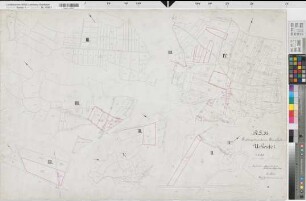
Luftbildpläne
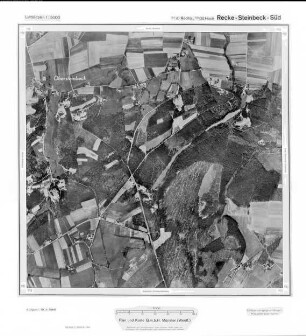
Recke-Steinbeck-Süd, Gauß-Krüger-Koordinaten: Rechtswert: 3410, Hochwert: 5800
- title of record
-
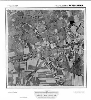
Recke-Middendorf, Gauß-Krüger-Koordinaten: Rechtswert: 3408, Hochwert: 5800
- Dimensions
-
Maßstab: 1:10.000
- Further information
-
Land: NRW
- Context
-
Hansa Luftbild: Luftbildpläne 1:10.000 >> 5. Rechtswerte beginnend mit 34 >> Recke-Middendorf, Gauß-Krüger-Koordinaten: Rechtswert: 3408, Hochwert: 5800
- Holding
-
RW 0434 Hansa Luftbild: Luftbildpläne 1:10.000
- Provenance
-
Hansa Luftbild
- Date of creation
-
April 1960
- Other object pages
- Delivered via
- Last update
-
2025-06-24T13:48:12+0200
Data provider
This object is provided by:
Landesarchiv Nordrhein-Westfalen. Abteilung Rheinland. If you have any questions about the object, please contact the data provider.
Landesarchiv Nordrhein-Westfalen. Abteilung Rheinland. If you have any questions about the object, please contact the data provider.
Object type
- Luftbildpläne
Associated
- Hansa Luftbild
Time of origin
- April 1960
Other Objects (12)

Recke, Steinbeck Süd, Gauß-Krüger-Koordinaten: Rechtswert: 3410, Hochwert: 5800
Recke - Steinbeck Süd, Gauß-Krüger-Koordinaten: Rechtswert: 3410, Hochwert: 5800
Recke, Steinbeck, Gauß-Krüger-Koordinaten: Rechtswert: 3410, Hochwert: 5802
Recke - Steinbeck, Gauß-Krüger-Koordinaten: Rechtswert: 3410, Hochwert: 5802
Recke-Steinbeck, Gauß-Krüger-Koordinaten: Rechtswert: 3410, Hochwert: 5802
Recke (Recke), Rentengutsache Steinbeck, Feldbücher
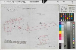
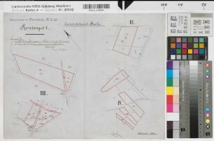
Recke (Recke), Rentengutsache Steinbeck, Schätzungsrisse
Recke (Recke), Rentengutsache Steinbeck, Rentengut II
Recke (Recke), Rentengutsache Steinbeck, Rentengut I
Recke, Poststelle I Steinbeck
Recke (Recke), Rentengutsache Steinbeck, Handzeichnungen der Rentengutsgrenzen
Recke (Recke), Rentengutsache Steinbeck, Katasterauszug Recke Flur 3-5
Recke, Steinbeck Süd, Gauß-Krüger-Koordinaten: Rechtswert: 3410, Hochwert: 5800
Recke - Steinbeck Süd, Gauß-Krüger-Koordinaten: Rechtswert: 3410, Hochwert: 5800
Recke, Steinbeck, Gauß-Krüger-Koordinaten: Rechtswert: 3410, Hochwert: 5802
Recke - Steinbeck, Gauß-Krüger-Koordinaten: Rechtswert: 3410, Hochwert: 5802
Recke-Steinbeck, Gauß-Krüger-Koordinaten: Rechtswert: 3410, Hochwert: 5802
Recke (Recke), Rentengutsache Steinbeck, Feldbücher
Recke (Recke), Rentengutsache Steinbeck, Schätzungsrisse
Recke (Recke), Rentengutsache Steinbeck, Rentengut II
Recke (Recke), Rentengutsache Steinbeck, Rentengut I
Recke, Poststelle I Steinbeck
Recke (Recke), Rentengutsache Steinbeck, Handzeichnungen der Rentengutsgrenzen