Akten
Landschaftsrahmenplan "Mittleres Ammer-Isar-Hügelland", hier: Erläuterungstext zur bodenkundlichen Übersichtskarte
- Reference number
-
Geologisches Landesamt, BayHStA, Geologisches Landesamt 141
- Language of the material
-
deutsch
- Further information
-
Registratursignatur/AZ: XXVII
- Context
-
2.11.2.1.1.1 Geologisches Landesamt 1 >> Umweltministerium >> Nachgeordneter Bereich >> Umwelt und Verbraucherschutz >> Geologisches Landesamt 1 >> 1.6. Geowissenschaftliche Untersuchungen >> 1.6.2 Bodenkunde >> 1.6.2.1 Bodenkunde allgemein
- Holding
-
Geologisches Landesamt 2.11.2.1.1.1 Geologisches Landesamt 1
- Indexbegriff subject
-
Landschaftsrahmenplan "Mittleres Ammer-Isar-Hügelland"
- Indexentry place
-
Ammer-Isar-Hügelland, Landschaftsrahmenplan
- Date of creation
-
1972
- Other object pages
- Last update
-
03.04.2025, 1:39 PM CEST
Data provider
This object is provided by:
Bayerisches Hauptstaatsarchiv. If you have any questions about the object, please contact the data provider.
Bayerisches Hauptstaatsarchiv. If you have any questions about the object, please contact the data provider.
Object type
- Akten
Time of origin
- 1972
Other Objects (12)

Modellstudie Ammer-Isar-Hügelland
Lüftlmalerei an Isar, Partnach, Loisach und Ammer
Ammer-Amper-Radweg : von den Bayerischen Alpen an die Isar
Alles im Fluss : Perspektiven für Isar, Loisach, Ammer und Lech
Sep. Ammern Ammern
Ammer, Kurt. Ammer, Karin
Pfaffenwinkel : 44 Radwanderungen auf Nebenwegen um Lech und Ammer, Loisach und Isar
Pfaffenwinkel : 44 Radwanderungen auf Nebenwegen um Lech und Ammer, Loisach und Isar
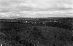
Hügelland : Blick über das Hügelland.
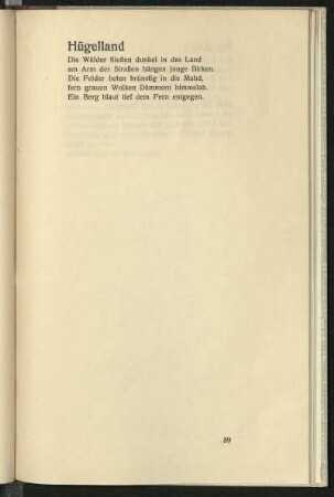
Hügelland
Freiraumkonzept Aschaffaue. Erläuterungstext

Erläuterungstext zur Navigationskunst
Modellstudie Ammer-Isar-Hügelland
Lüftlmalerei an Isar, Partnach, Loisach und Ammer
Ammer-Amper-Radweg : von den Bayerischen Alpen an die Isar
Alles im Fluss : Perspektiven für Isar, Loisach, Ammer und Lech
Sep. Ammern Ammern
Ammer, Kurt. Ammer, Karin
Pfaffenwinkel : 44 Radwanderungen auf Nebenwegen um Lech und Ammer, Loisach und Isar
Pfaffenwinkel : 44 Radwanderungen auf Nebenwegen um Lech und Ammer, Loisach und Isar
Hügelland : Blick über das Hügelland.
Hügelland
Freiraumkonzept Aschaffaue. Erläuterungstext