Luftbildpläne
Neugrabener Heide, Gauß-Krüger-Koordinaten: Rechtswert: 3558, Hochwert: 5924
- title of record
-
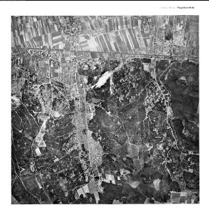
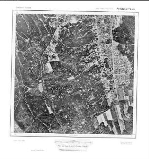
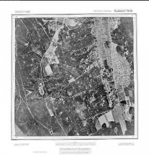
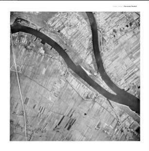
Fischbeker Heide, Gauß-Krüger-Koordinaten: Rechtswert: 3556, Hochwert: 5924
- Dimensions
-
Maßstab: 1:10.000
- Further information
-
Land: Hamburg
- Context
-
Hansa Luftbild: Luftbildpläne 1:10.000 >> 6. Rechtswerte beginnend mit 35 >> Fischbeker Heide, Gauß-Krüger-Koordinaten: Rechtswert: 3556, Hochwert: 5924
- Holding
-
RW 0434 Hansa Luftbild: Luftbildpläne 1:10.000
- Creator
-
Hersteller: Hansa Luftbild
- Provenance
-
Hansa Luftbild
- Date of creation
-
1954
- Other object pages
- Delivered via
- Last update
-
30.04.2025, 2:45 PM CEST
Data provider
This object is provided by:
Landesarchiv Nordrhein-Westfalen. Abteilung Rheinland. If you have any questions about the object, please contact the data provider.
Landesarchiv Nordrhein-Westfalen. Abteilung Rheinland. If you have any questions about the object, please contact the data provider.
Object type
- Luftbildpläne
Associated
- Hersteller: Hansa Luftbild
- Hansa Luftbild
Time of origin
- 1954
Other Objects (12)

Neugrabener Heide, Gauß-Krüger-Koordinaten: Rechtswert: 3558, Hochwert: 5924
Fischbeker Heide, Gauß-Krüger-Koordinaten: Rechtswert: 3556, Hochwert: 5924
Fischbeker Heide, Gauß-Krüger-Koordinaten: Rechtswert: 3556, Hochwert: 5924
Fischbeker Heide, Gauß-Krüger-Koordinaten: Rechtswert: 3556, Hochwert: 5924

Neugrabener Heide, Gauß-Krüger-Koordinaten: Rechtswert: 3558, Hochwert: 5926
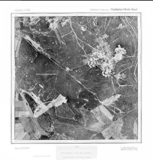
Fischbeker Heide West, Gauß-Krüger-Koordinaten: Rechtswert: 3554, Hochwert: 5924
Fischbeker Heide-West, Gauß-Krüger-Koordinaten: Rechtswert: 3554, Hochwert: 5924
![[Dangast], Gauß-Krüger-Koordinaten: Rechtswert: 3438, Hochwert: 5924](https://iiif.deutsche-digitale-bibliothek.de/image/2/b6caafb2-cc44-4e4d-a484-7182bed3a3f0/full/!306,450/0/default.jpg)
[Dangast], Gauß-Krüger-Koordinaten: Rechtswert: 3438, Hochwert: 5924
Brammerhagen, Gauß-Krüger-Koordinaten: Rechtswert: 3568, Hochwert: 5924
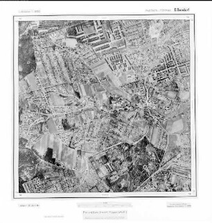
Eißendorf, Gauß-Krüger-Koordinaten: Rechtswert: 3562, Hochwert: 5924
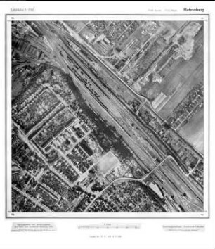
Metzenberg, Gauß-Krüger-Koordinaten: Rechtswert: 3566, Hochwert: 5924

Oortkaten, Gauß-Krüger-Koordinaten: Rechtswert: 3572, Hochwert: 5924
Neugrabener Heide, Gauß-Krüger-Koordinaten: Rechtswert: 3558, Hochwert: 5924
Fischbeker Heide, Gauß-Krüger-Koordinaten: Rechtswert: 3556, Hochwert: 5924
Fischbeker Heide, Gauß-Krüger-Koordinaten: Rechtswert: 3556, Hochwert: 5924
Fischbeker Heide, Gauß-Krüger-Koordinaten: Rechtswert: 3556, Hochwert: 5924
Neugrabener Heide, Gauß-Krüger-Koordinaten: Rechtswert: 3558, Hochwert: 5926
Fischbeker Heide West, Gauß-Krüger-Koordinaten: Rechtswert: 3554, Hochwert: 5924
Fischbeker Heide-West, Gauß-Krüger-Koordinaten: Rechtswert: 3554, Hochwert: 5924
[Dangast], Gauß-Krüger-Koordinaten: Rechtswert: 3438, Hochwert: 5924
Brammerhagen, Gauß-Krüger-Koordinaten: Rechtswert: 3568, Hochwert: 5924
Eißendorf, Gauß-Krüger-Koordinaten: Rechtswert: 3562, Hochwert: 5924
Metzenberg, Gauß-Krüger-Koordinaten: Rechtswert: 3566, Hochwert: 5924