Karte / Plan
Ramsdorf (Velen) Flächennutzungsplan, 2. Änderung (Ortskern) 1966/71/72 1 : 5000 63,5 x 58 Einzeichnung in Pause Regierung Münster
- Former reference number
-
Regierung Münster
- Further information
-
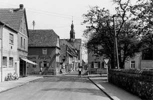
Ort: Ramsdorf, Velen
- Context
-
Karten A (Allgemein) >> 2. Land- und Forstwirtschaft >> 2.11. Flächennutzungspläne
- Holding
-
W 051 Karten A (Allgemein)
- Indexentry place
-
Ramsdorf, Velen
Ramsdorf, Flächennutzungsplan, 1966
- Date of creation
-
1966
- Other object pages
- Provenance
-
Sammlungsregistraturbildner
- Delivered via
- Last update
-
17.09.2025, 3:11 PM CEST
Data provider
This object is provided by:
Landesarchiv Nordrhein-Westfalen. Abteilung Westfalen. If you have any questions about the object, please contact the data provider.
Landesarchiv Nordrhein-Westfalen. Abteilung Westfalen. If you have any questions about the object, please contact the data provider.
Object type
- Karten / Pläne
Time of origin
- 1966
Other Objects (12)

Flächennutzungsplan von Ramsdorf mit den Ortsteilen Hagenest und Wildenhain
Gesamtanlage Ortskern; Fürth, Gesamtanlage Ortskern
Gesamtanlage Ortskern; Hattersheim, Gesamtanlage Ortskern
Ortskern
Ortskern
Ortskern
Ortskern
Ortskern
Ortskern
Ortskern
Ortskern
Ortskern
Flächennutzungsplan von Ramsdorf mit den Ortsteilen Hagenest und Wildenhain
Gesamtanlage Ortskern; Fürth, Gesamtanlage Ortskern
Gesamtanlage Ortskern; Hattersheim, Gesamtanlage Ortskern
Ortskern
Ortskern
Ortskern
Ortskern
Ortskern
Ortskern
Ortskern
Ortskern
Ortskern
Flächennutzungsplan von Ramsdorf mit den Ortsteilen Hagenest und Wildenhain
Gesamtanlage Ortskern; Fürth, Gesamtanlage Ortskern
Gesamtanlage Ortskern; Hattersheim, Gesamtanlage Ortskern
Ortskern
Ortskern
Ortskern
Ortskern
Ortskern
Ortskern
Ortskern
Ortskern