- Alternative title
-
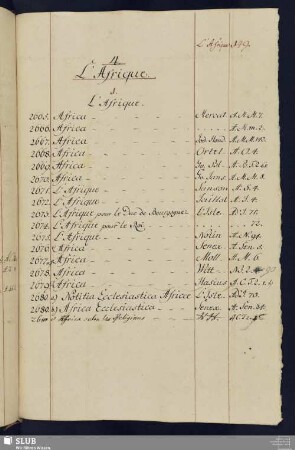
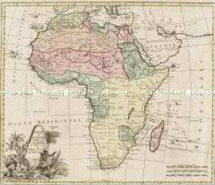
L'AFRIQUE / revüe corrigée et publiée, / Par M. Moithey, ingénieur-géographe du Roi, et professeur de Mathématiques / de MM. les pages de S. A. S. Monseigneur
- Location
-
Deutsches Historisches Museum, Berlin
- Inventory number
-
Do 2006/947
- Measurements
-
Höhe x Breite: 79 x 108 cm (Blatt)
Höhe x Breite: 69 x 96 cm (Karte)
Höhe x Breite: 72,5 x 99,5 cm (Platte)
- Material/Technique
-
Papier, Kupferstich, grenzkoloriert
- Classification
-
Kartografie (Gattung)
- Subject (what)
-
Afrika
- Event
-
Herstellung
- (who)
-
Geograph, Verleger: Maurille Antoine Moithey
Geograph, Stecher, Verleger: Jean-Baptiste Crépy
Stecher (Kartusche): ? Desrais?
Stecher: P. G. Tavenard
- (where)
-
Paris, Frankreich [historisch: Frankreich, Königreich]
- (when)
-
1785
- Rights
-
Deutsches Historisches Museum
- Last update
-
24.03.2023, 9:27 AM CET
Data provider
This object is provided by:
Stiftung Deutsches Historisches Museum. If you have any questions about the object, please contact the data provider.
Stiftung Deutsches Historisches Museum. If you have any questions about the object, please contact the data provider.
Object type
- Kontinentalkarte
Associated
- Geograph, Verleger: Maurille Antoine Moithey
- Geograph, Stecher, Verleger: Jean-Baptiste Crépy
- Stecher (Kartusche): ? Desrais?
- Stecher: P. G. Tavenard
Time of origin
- 1785
Other Objects (12)
L'AFRIQUE
L'Afrique
L'Afrique
4. L'Afrique
L'Afrique Orientale.

L'afrique danse
L'Afrique Orientale.
4. L'Afrique

André-Jean Tudesq: L'Afrique parle, l'Afrique écoute. Les radios en Afrique subsaharienne
Charte de l'Afrique
Description de l'Afrique

L'Afrique Centrale Anglaise.
L'AFRIQUE
L'Afrique
L'Afrique
4. L'Afrique
L'Afrique Orientale.
L'afrique danse
L'Afrique Orientale.
4. L'Afrique
André-Jean Tudesq: L'Afrique parle, l'Afrique écoute. Les radios en Afrique subsaharienne
Charte de l'Afrique
Description de l'Afrique
L'Afrique Centrale Anglaise.
L'AFRIQUE
L'Afrique
L'Afrique
4. L'Afrique
L'Afrique Orientale.
L'afrique danse
L'Afrique Orientale.
4. L'Afrique
André-Jean Tudesq: L'Afrique parle, l'Afrique écoute. Les radios en Afrique subsaharienne
Charte de l'Afrique
Description de l'Afrique