- Alternative title
-
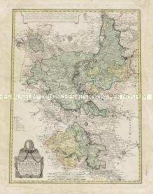
Mappa Geographica / REGNI POLONIAE / ex novissimis quotquot sunt / mappis specialibus composita ...
- Location
-
Deutsches Historisches Museum, Berlin
- Inventory number
-
Do 2003/13
- Measurements
-
Höhe x Breite: 52,7 x 61,6 cm (Blatt)
Höhe x Breite: 47,8 x 54 cm (Platte)
- Material/Technique
-
Druckfarbe, Gouache, Papier, Kupferstich, koloriert
- Classification
-
Kartografie (Gattung)
- Subject (what)
-
Polen
- Event
-
Herstellung
- (who)
-
Kartograf: Johann Tobias Mayer
Verlag: Homannsche Erben
- (where)
-
Deutschland
- (when)
-
1773
- Rights
-
Deutsches Historisches Museum
- Last update
-
24.03.2023, 9:28 AM CET
Data provider
This object is provided by:
Stiftung Deutsches Historisches Museum. If you have any questions about the object, please contact the data provider.
Stiftung Deutsches Historisches Museum. If you have any questions about the object, please contact the data provider.
Object type
- Grenzkarte
Associated
- Kartograf: Johann Tobias Mayer
- Verlag: Homannsche Erben
Time of origin
- 1773
Other Objects (12)
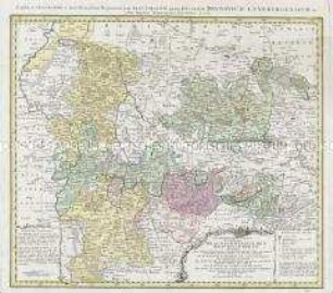
Geographische Lage der südlichen Braunschweigischen Reichsgebiete
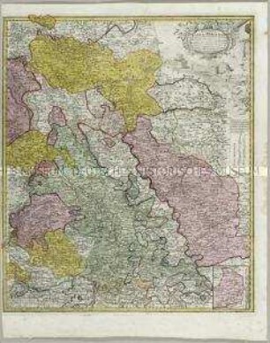
Ducatus Iuliaci et Bergensis Tabula geographica. Mit einer Anschlusskarte

Karte: Beschreibung der Schweiz; 1751
BORUSSIAE - REGNUM
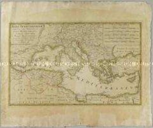
Mare Mediterraneum
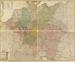
Charte von Deutschland
Das Herzogthum Magdeburg
Regnum Borussiae. Karte des Königreichs Preußen. M ca. 1 : 730 000
Karte von Deutschland
Karte: Beschreibung der Schweiz

Indemnisations Karte von Deutschland
Karte vom Königreich Preußen
Geographische Lage der südlichen Braunschweigischen Reichsgebiete
Ducatus Iuliaci et Bergensis Tabula geographica. Mit einer Anschlusskarte
Karte: Beschreibung der Schweiz; 1751
BORUSSIAE - REGNUM
Mare Mediterraneum
Charte von Deutschland
Das Herzogthum Magdeburg
Regnum Borussiae. Karte des Königreichs Preußen. M ca. 1 : 730 000
Karte von Deutschland
Karte: Beschreibung der Schweiz
Indemnisations Karte von Deutschland