- Alternative title
-
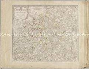
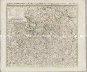
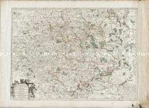
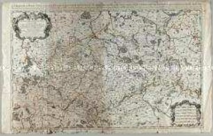
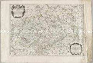
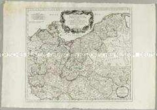
PARTIE MERIDIONALE DU / CERCLE DE HAUTE SAXE / òu sont / LE DUCHÉ DE SAXE, LE MARQUISAT DE
- Location
-
Deutsches Historisches Museum, Berlin
- Inventory number
-
Do 2006/861
- Measurements
-
Höhe x Breite: 55 x 78 cm (Blatt)
Höhe x Breite: 46 x 51,5 cm (Karte)
Höhe x Breite: 49,5 x 55,5 cm (Platte)
- Material/Technique
-
Papier, Kupferstich, grenzkoloriert
- Classification
-
Kartografie (Gattung)
- Subject (what)
-
Obersächsischer Reichskreis
Deutschland
- Event
-
Herstellung
- (who)
-
Geograph, Kartograf: Didier Robert de Vaugondy
Stecher, Kartograf: Paolo Santini
Kartograf, Verleger: Giuseppe Antonio Remondini
- (where)
-
Venedig, Italien
- (when)
-
um 1778
- Rights
-
Deutsches Historisches Museum
- Last update
-
2023-03-24T09:28:16+0100
Data provider
This object is provided by:
Stiftung Deutsches Historisches Museum. If you have any questions about the object, please contact the data provider.
Stiftung Deutsches Historisches Museum. If you have any questions about the object, please contact the data provider.
Object type
- Kreiskarte
Associated
- Geograph, Kartograf: Didier Robert de Vaugondy
- Stecher, Kartograf: Paolo Santini
- Kartograf, Verleger: Giuseppe Antonio Remondini
Time of origin
- um 1778
Other Objects (12)
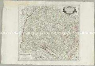
Partie Meridionale du Cercle de Haute Saxe
Partie Méridionale du Cercle de Haute Saxe
Cercle Meridional de la Haute Saxe
Le Cercle de la Haute Saxe
Le Cercle de la Haute Saxe
Cercle de Basse Saxe
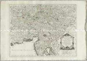
Partie Méridionale du Cercle d'Autriche
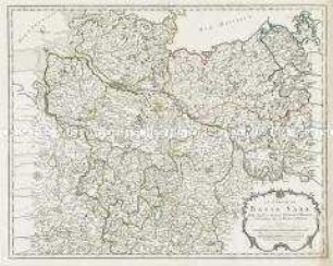
Le Cercle De Basse Saxe
Le Cercle de la Basse Saxe
Le Cercle De La Basse Saxe
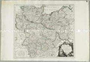
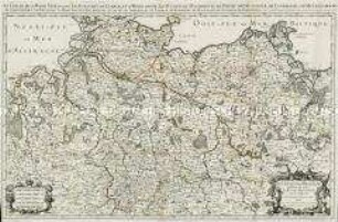
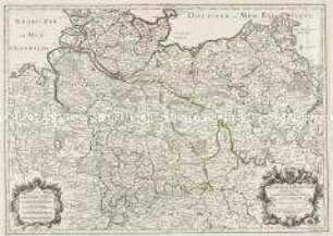
Partie Septentrionale du Cercle de Haute Saxe. Mit einer Nebenkarte: Supplément pour le Marquisat de Brandebourg
Cercle de Souabe
Partie Meridionale du Cercle de Haute Saxe
Partie Méridionale du Cercle de Haute Saxe
Cercle Meridional de la Haute Saxe
Le Cercle de la Haute Saxe
Le Cercle de la Haute Saxe
Cercle de Basse Saxe
Partie Méridionale du Cercle d'Autriche
Le Cercle De Basse Saxe
Le Cercle de la Basse Saxe
Le Cercle De La Basse Saxe
Partie Septentrionale du Cercle de Haute Saxe. Mit einer Nebenkarte: Supplément pour le Marquisat de Brandebourg