Kreiskarte
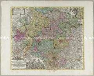
Partie Septentrionale du Cercle de Haute Saxe. Mit einer Nebenkarte: Supplément pour le Marquisat de Brandebourg
- Alternativer Titel
-
PARTIE SEPTENTRIONALE / DU CERCLE DE HAUTE SAXE / qui contient / LE DUCHÉ DE POMÉRANIE,
- Standort
-
Deutsches Historisches Museum, Berlin
- Inventarnummer
-
Do 2006/862
- Maße
-
Höhe x Breite: 55 x 78 cm (Blatt)
Höhe x Breite: 45,5 x 52 cm (Karte)
Höhe x Breite: 49,5 x 55,7 cm (Platte)
- Material/Technik
-
Papier, Kupferstich, grenzkoloriert
- Klassifikation
-
Kartografie (Gattung)
- Bezug (was)
-
Deutschland
- Ereignis
-
Herstellung
- (wer)
-
Kartograf, Geograph: Didier Robert de Vaugondy
Stecher, Kartograf: Paolo Santini
Kartograf, Verleger: Giuseppe Antonio Remondini
- (wo)
-
Venedig, Italien
- (wann)
-
um 1778
- Rechteinformation
-
Deutsches Historisches Museum
- Letzte Aktualisierung
-
24.03.2023, 09:27 MEZ
Datenpartner
Dieses Objekt wird bereitgestellt von:
Stiftung Deutsches Historisches Museum. Bei Fragen zum Objekt wenden Sie sich bitte an den Datenpartner.
Stiftung Deutsches Historisches Museum. Bei Fragen zum Objekt wenden Sie sich bitte an den Datenpartner.
Objekttyp
- Kreiskarte
Beteiligte
- Kartograf, Geograph: Didier Robert de Vaugondy
- Stecher, Kartograf: Paolo Santini
- Kartograf, Verleger: Giuseppe Antonio Remondini
Entstanden
- um 1778
Ähnliche Objekte (12)
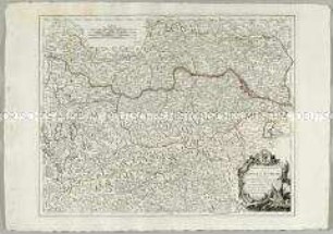
Partie Septentrionale du Cercle d'Autriche

England. Mit einer Nebenkarte: Scilly Inseln
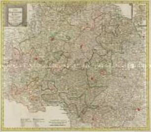
Circulus Franconicus. Mit einer Nebenkarte: Comit. Erbacensis
Der Fraenkische Kreis. Mit einer Nebenkarte: Grafsch. Erbach

Der Schwaebische Kreis. Mit einer Nebenkarte: Fürst. Lichtenstein

Die Baierische Monarchie. Mit einer Nebenkarte: Der Rheinkreis

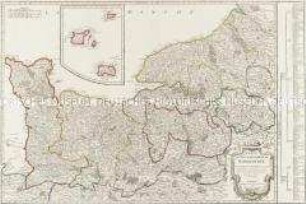
Partie Septentrionale De La Souabe / Partie Méridionale De La Souabe
Carte du Gouvernement de Normandie. Mit einer Nebenkarte (Kanalinseln)

Die baierische Monarchie, entworfen in zwey Blättern. Mit einer Nebenkarte: Supplement

Carte de la République Française. Mit einer Nebenkarte: Isle de Corse

Ducatus Wurtenbergici. Mit einer Nebenkarte: Sylvae Herciniae sive Martiae; und zwei Ansichten: Tübingen; Stuttgart

Der Schwaebische Kreis nebst den österreichischen Besizungen in Schwaben. Mit einer Nebenkarte: Fürstent. Lichtenstein
Partie Septentrionale du Cercle d'Autriche
England. Mit einer Nebenkarte: Scilly Inseln
Circulus Franconicus. Mit einer Nebenkarte: Comit. Erbacensis
Der Fraenkische Kreis. Mit einer Nebenkarte: Grafsch. Erbach
Der Schwaebische Kreis. Mit einer Nebenkarte: Fürst. Lichtenstein
Die Baierische Monarchie. Mit einer Nebenkarte: Der Rheinkreis
Partie Septentrionale De La Souabe / Partie Méridionale De La Souabe
Carte du Gouvernement de Normandie. Mit einer Nebenkarte (Kanalinseln)
Die baierische Monarchie, entworfen in zwey Blättern. Mit einer Nebenkarte: Supplement
Carte de la République Française. Mit einer Nebenkarte: Isle de Corse
Ducatus Wurtenbergici. Mit einer Nebenkarte: Sylvae Herciniae sive Martiae; und zwei Ansichten: Tübingen; Stuttgart