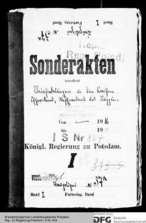
Archivale
Gemeinde-Karteikarten Kreise Luckenwalde, Osthavelland, Ruppin, Teltow
Enthält u. a.: Bevölkerung, Fläche, Wohnhäuserbestand, Energie, Wasser, Gesundheitswesen, Schulen, Anstalten, Betriebe usw.
- Reference number
-
202C HAWiPla 1119
- Context
-
Rep. 202C Hauptabteilung Wirtschaftsplanung >> Regionale Planung
- Holding
-
202C HAWiPla (53206) Rep. 202C Hauptabteilung Wirtschaftsplanung
- Date of creation
-
1946
- Other object pages
- Last update
-
07.04.2025, 11:28 AM CEST
Data provider
This object is provided by:
Brandenburgisches Landeshauptarchiv. If you have any questions about the object, please contact the data provider.
Brandenburgisches Landeshauptarchiv. If you have any questions about the object, please contact the data provider.
Object type
- Archivale
Time of origin
- 1946
Other Objects (12)

Gemeinde-Karteikarten Kreise Luckenwalde, Osthavelland, Ostprignitz, Ruppin, Westprignitz
Gemeinde-Karteikarten Kreise Beeskow-Storkow, Niederbarnim, Osthavelland, Ruppin, Teltow, Westhavelland
Gemeinde-Karteikarten Kreise Osthavelland, Ostprignitz, Ruppin, Templin, Westhavelland
Arbeitspläne und -berichte der Bibliotheken der Kreise Brandenburg, Luckenwalde, Osthavelland,Ostprignitz, Potsdam, Ruppin, Teltow, Westhavelland, Zauch-Belzig.
Kreissparkassen Luckenwalde, Osthavelland, Ostprignitz, Ruppin, Teltow, Westhavelland, Zauch-Belzig und der Stadtsparkassen Brandenburg (Havel) und Potsdam für 1951
Mitschurinarbeit in den Kreisen Brandenburg, Luckenwalde, Osthavelland, Ostprignitz, Ruppin und Westhavelland
Quartalspläne der Räte der Kreise Luckenwalde, Osthavelland, Teltow, Westhavelland, Zauch-Belzig
[Kreise Ruppin und Osthavelland]
Aufstellung von Dorfwirtschaftsplänen in den Kreisen Brandenburg, Luckenwalde, Osthavelland, Ostprignitz, Potsdam und Ruppin
Kreissparkassen Lübbenau, Luckau, Luckenwalde, Osthavelland, Teltow, Westprignitz und der Stadtsparkasse Potsdam für 1950
Gemeinde-Karteikarten Kreise Luckenwalde und Zauch-Belzig
Kleinsiedlungen in den Kreisen Osthavelland, Westhavelland und Ruppin
Gemeinde-Karteikarten Kreise Luckenwalde, Osthavelland, Ostprignitz, Ruppin, Westprignitz
Gemeinde-Karteikarten Kreise Beeskow-Storkow, Niederbarnim, Osthavelland, Ruppin, Teltow, Westhavelland
Gemeinde-Karteikarten Kreise Osthavelland, Ostprignitz, Ruppin, Templin, Westhavelland
Arbeitspläne und -berichte der Bibliotheken der Kreise Brandenburg, Luckenwalde, Osthavelland,Ostprignitz, Potsdam, Ruppin, Teltow, Westhavelland, Zauch-Belzig.
Kreissparkassen Luckenwalde, Osthavelland, Ostprignitz, Ruppin, Teltow, Westhavelland, Zauch-Belzig und der Stadtsparkassen Brandenburg (Havel) und Potsdam für 1951
Mitschurinarbeit in den Kreisen Brandenburg, Luckenwalde, Osthavelland, Ostprignitz, Ruppin und Westhavelland
Quartalspläne der Räte der Kreise Luckenwalde, Osthavelland, Teltow, Westhavelland, Zauch-Belzig
[Kreise Ruppin und Osthavelland]
Aufstellung von Dorfwirtschaftsplänen in den Kreisen Brandenburg, Luckenwalde, Osthavelland, Ostprignitz, Potsdam und Ruppin
Kreissparkassen Lübbenau, Luckau, Luckenwalde, Osthavelland, Teltow, Westprignitz und der Stadtsparkasse Potsdam für 1950
Gemeinde-Karteikarten Kreise Luckenwalde und Zauch-Belzig