- Location
-
Deutsches Historisches Museum, Berlin
- Inventory number
-
1988/1517
- Measurements
-
Höhe x Breite: 52 x 61 cm (Blatt), Höhe x Breite: 49,8 x 59 cm (Platte), Höhe x Breite: 46,7 x 55,8 cm (Karte)
- Material/Technique
-
Papier, Kupferstich, koloriert
- Classification
-
Kartografie (Gattung)
- Subject (what)
-
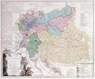
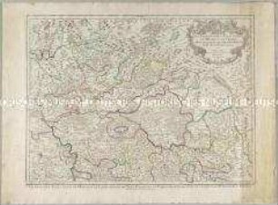
Preußen (Königreich, 1701-1918)
- Event
-
Herstellung
- (who)
-
Geograph, Kartograf: Johann Baptist Homann
- (where)
-
Nürnberg
- (when)
-
um 1740
- Rights
-
Deutsches Historisches Museum
- Last update
-
24.03.2023, 9:29 AM CET
Data provider
This object is provided by:
Stiftung Deutsches Historisches Museum. If you have any questions about the object, please contact the data provider.
Stiftung Deutsches Historisches Museum. If you have any questions about the object, please contact the data provider.
Object type
- Grenzkarte
Associated
- Geograph, Kartograf: Johann Baptist Homann
Time of origin
- um 1740
Other Objects (12)

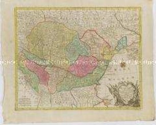
BORUSSIAE - REGNUM
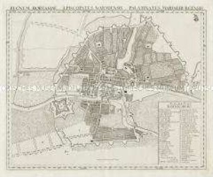
Regnum Borussiae. Mit einem Stadtplan: Koenigsberg
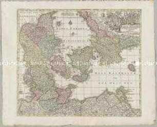
Daniae Regnum
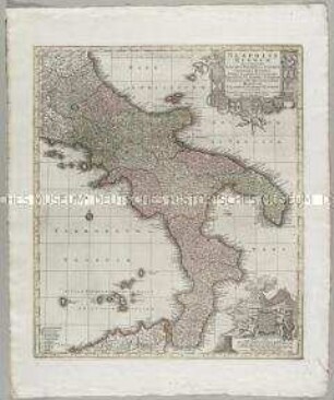
Neapolis Regnum. Mit einer Ansicht: Vesuvius Mons
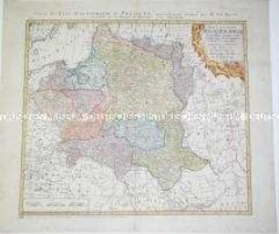
Karte des Königreichs Polen
Brion et Maire: Tableau Géographique Et Politique De L'Allemagne. Blatt 2: Carte Élementaire Et Statistique De L'Allemagne, Conformément au traité de paix de Lunéville, de l'an 9 - 1801; et au recès de la diète de l'Empire, à Ratisbonne, de l'an 11 - 1803. Carte Comprenant, En Entier, La Confédération Du Rhin, Les Etats Autrichens Et Prussiens suivant le traité de Presbourg en 1805 et ceux de Tilsitt en 1807. Par BRION et MAIRE, Ingenieurs-Géographes. Nouvelle édition augmentée, surtout des positions les plus signalées par la marche victorieuse et inoure des armées françaises, et par des conventions ou traités. 1809.
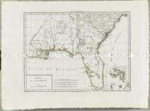
Atlas Nouveau: Carte de la Floride et de la Georgie
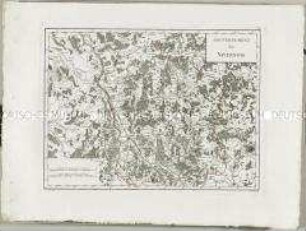
Atlas Nouveau: Gouvernement de Nivernois
Tabula Hungaria
Atlas Nouveau: Gouvernement d'Anjou
Les Archeveschés et Eslectorats de Mayence et de Treves, Le Palatinat et Eslectorat du Rhein, le Duché de Wirtenberg

Novissima et Accuratissima Helvetiae
BORUSSIAE - REGNUM
Regnum Borussiae. Mit einem Stadtplan: Koenigsberg
Daniae Regnum
Neapolis Regnum. Mit einer Ansicht: Vesuvius Mons
Karte des Königreichs Polen
Brion et Maire: Tableau Géographique Et Politique De L'Allemagne. Blatt 2: Carte Élementaire Et Statistique De L'Allemagne, Conformément au traité de paix de Lunéville, de l'an 9 - 1801; et au recès de la diète de l'Empire, à Ratisbonne, de l'an 11 - 1803. Carte Comprenant, En Entier, La Confédération Du Rhin, Les Etats Autrichens Et Prussiens suivant le traité de Presbourg en 1805 et ceux de Tilsitt en 1807. Par BRION et MAIRE, Ingenieurs-Géographes. Nouvelle édition augmentée, surtout des positions les plus signalées par la marche victorieuse et inoure des armées françaises, et par des conventions ou traités. 1809.
Atlas Nouveau: Carte de la Floride et de la Georgie
Atlas Nouveau: Gouvernement de Nivernois
Tabula Hungaria
Atlas Nouveau: Gouvernement d'Anjou
Les Archeveschés et Eslectorats de Mayence et de Treves, Le Palatinat et Eslectorat du Rhein, le Duché de Wirtenberg