- Alternativer Titel
-
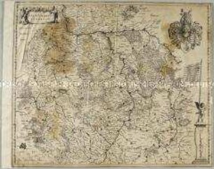
PALATINATVS/ POSNANIENSIS,/ IN MAIORI POLONIA PRIMARII/ NOVA DELINEATIO/ Per G.F.M.
- Standort
-
Deutsches Historisches Museum, Berlin
- Inventarnummer
-
Do 2002/35
- Maße
-
Höhe x Breite: 54 x 61,5 cm (Blatt), Höhe x Breite: 45,6 x 53,2 cm (Platte)
- Material/Technik
-
Papier, Kupferstich, koloriert
- Klassifikation
-
Kartografie (Gattung)
- Bezug (was)
-
Posen
- Ereignis
-
Herstellung
- (wer)
-
Kartograf: Monogrammist G.F.M. (Meyer, Georg Friedrich?)
- (wo)
-
Deutschland [historisch: Heiliges Römisches Reich]
- (wann)
-
um 1650
- Rechteinformation
-
Deutsches Historisches Museum
- Letzte Aktualisierung
-
24.03.2023, 09:31 MEZ
Datenpartner
Dieses Objekt wird bereitgestellt von:
Stiftung Deutsches Historisches Museum. Bei Fragen zum Objekt wenden Sie sich bitte an den Datenpartner.
Stiftung Deutsches Historisches Museum. Bei Fragen zum Objekt wenden Sie sich bitte an den Datenpartner.
Objekttyp
- Regionalkarte
Beteiligte
- Kartograf: Monogrammist G.F.M. (Meyer, Georg Friedrich?)
Entstanden
- um 1650
Ähnliche Objekte (12)
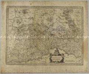
Palatinatus Bavariae
Palatinatus ad Rhenum

Ukrainae Pars, quae Podolia Palatinatus
La Province d'Alsace

Carte Générale de l'Empire d'Allemagne. Mit einer Übersichtskarte
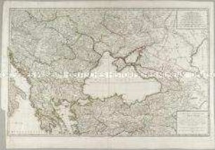
Carte des environs de la Mer-Noire
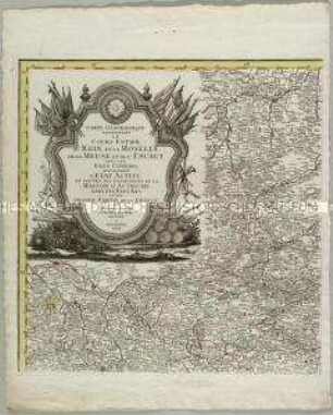
Carte Geographique representant le cours entier du Rhin, de la Moselle, de la Meuse et de l'Escaut

Kolorierte Tuschfederzeichnung der Grafschaft Eger
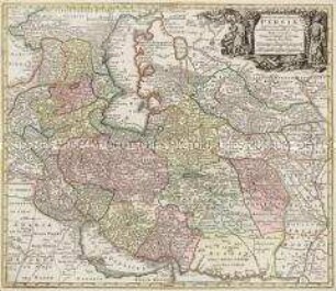
Opulentissimi Regni Persiae iuxta suas Provincias
La Principauté d'Orange et Comtat de Venaissin

Icon Sinus Baiarum
Karte: Beschreibung der Schweiz
Palatinatus Bavariae
Palatinatus ad Rhenum
Ukrainae Pars, quae Podolia Palatinatus
La Province d'Alsace
Carte Générale de l'Empire d'Allemagne. Mit einer Übersichtskarte
Carte des environs de la Mer-Noire
Carte Geographique representant le cours entier du Rhin, de la Moselle, de la Meuse et de l'Escaut
Kolorierte Tuschfederzeichnung der Grafschaft Eger
Opulentissimi Regni Persiae iuxta suas Provincias
La Principauté d'Orange et Comtat de Venaissin
Icon Sinus Baiarum