Karte / Plan
[Plan des Stadtkreises Solingen in 6 Blättern: Blatt Nordosten]. Nebenkarte: Innerer Stadteil 1:1250, 33x46 cm
- Former reference number
-
Stadtpläne. I.Abteilung des Bezirks-Ausschusses. Zimmer I No.32
- Dimensions
-
Höhe: 88 cm, Breite: 107, Maßstab: 1:2.500
- Notes
-
Unbeschädigt; Blatt Nordwesten fehlt
- Context
-
RW Karten >> 6. Siedlungen >> 6.1. Stadtpläne >> 6.1.55. Solingen
- Holding
-
RW Karten
- Date of creation
-
[ca. 1903]
- Other object pages
- Provenance
-
Diverse Registraturbildner
- Delivered via
- Last update
-
05.11.2025, 3:25 PM CET
Data provider
This object is provided by:
Landesarchiv Nordrhein-Westfalen. Abteilung Rheinland. If you have any questions about the object, please contact the data provider.
Landesarchiv Nordrhein-Westfalen. Abteilung Rheinland. If you have any questions about the object, please contact the data provider.
Object type
- Karten / Pläne
Time of origin
- [ca. 1903]
Other Objects (12)

Gesamtlageplan 1:1250
Germarkung Sieglar Flur 7 (1:1250) u. 8 (1:1250) u. 10 (1:2500) u. 11 (1:1250)
Gemarkung Teveren Planblatt A : 1:1250 Planblatt B : 1:1250 Planblatt B : 1:2500 Planblatt C : 1:1250
Flur A Anlage (1:1250) u. Flur Blatt 1 (1:1250)
Flur H Beiblätter (1:1250) u. Flur M Beiblatt (1:1250)
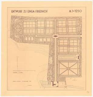
Friedhof: Grundriss 1:1250
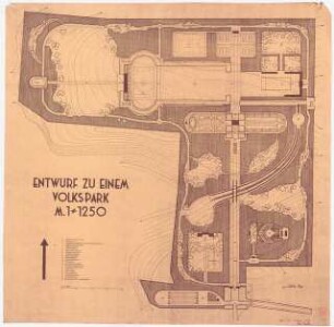
Volkspark: Grundriss 1:1250
Flur 7 (1:5.000) / 8 (1:1.250) und 15 (teilweise) (1:1.250)
Germarkung Sieglar Flur 12 (1:1250) u. Flur 13 (teilw.) (1:1250)
Gemarkung Arsbeck Flur 3 : 1:1250, Flur 5 : 1:1000, Flur 12 : 1:2500; Gemarkung Boal Flur 8 : 1:2500; Gemarkung Gerderath Flur 4 : 1:1250, Flur 5 : 1:1250, Flur 6 : 1:1250; Gemarkung Niederkrüchten Flur 11 : 1:1250, Flur 12 : 1:2500; Gemarkung Rheindahlen Flur O : 1:1250, Flur Q : 1:1250
Bebauungsplan Duisburg (festgestellt). 1:1250
Kreiskrankenhaus, Gardelegen: Lageplan 1:1250
Gesamtlageplan 1:1250
Germarkung Sieglar Flur 7 (1:1250) u. 8 (1:1250) u. 10 (1:2500) u. 11 (1:1250)
Gemarkung Teveren Planblatt A : 1:1250 Planblatt B : 1:1250 Planblatt B : 1:2500 Planblatt C : 1:1250
Flur A Anlage (1:1250) u. Flur Blatt 1 (1:1250)
Flur H Beiblätter (1:1250) u. Flur M Beiblatt (1:1250)
Friedhof: Grundriss 1:1250
Volkspark: Grundriss 1:1250
Flur 7 (1:5.000) / 8 (1:1.250) und 15 (teilweise) (1:1.250)
Germarkung Sieglar Flur 12 (1:1250) u. Flur 13 (teilw.) (1:1250)
Gemarkung Arsbeck Flur 3 : 1:1250, Flur 5 : 1:1000, Flur 12 : 1:2500; Gemarkung Boal Flur 8 : 1:2500; Gemarkung Gerderath Flur 4 : 1:1250, Flur 5 : 1:1250, Flur 6 : 1:1250; Gemarkung Niederkrüchten Flur 11 : 1:1250, Flur 12 : 1:2500; Gemarkung Rheindahlen Flur O : 1:1250, Flur Q : 1:1250
Bebauungsplan Duisburg (festgestellt). 1:1250