Karte / Plan
Westfälischer Kreis Territorialkarte Charte vom Westphaelischen Kreise 1804 1 geogr. Meile = 5,45 cm 53 x 45 farb. Stich: Weimar, Verlag des Geographischen Instituts nach Lecoq von D. G. Reymann B Nr. 355c
- Alt-/Vorsignatur
-
355c
- Sonstige Erschließungsangaben
-
Ort: Westfälischer Kreis
- Kontext
-
Karten A (Allgemein) >> 1. Topographische Karte, Übersichtskarten >> 1.3. Territorialkarten
- Bestand
-
W 051 Karten A (Allgemein)
- Indexbegriff Ort
-
Westfälischer Kreis
Westfälischer Kreis, Territorialkarte, 1804
- Laufzeit
-
1804
- Weitere Objektseiten
- Provenienz
-
Sammlungsregistraturbildner
- Geliefert über
- Letzte Aktualisierung
- 05.11.2025, 15:28 MEZ
Datenpartner
Dieses Objekt wird bereitgestellt von:
Landesarchiv Nordrhein-Westfalen. Abteilung Westfalen. Bei Fragen zum Objekt wenden Sie sich bitte an den Datenpartner.
Landesarchiv Nordrhein-Westfalen. Abteilung Westfalen. Bei Fragen zum Objekt wenden Sie sich bitte an den Datenpartner.
Objekttyp
- Karten / Pläne
Entstanden
- 1804
Ähnliche Objekte (12)

Lecoq
Lecoq
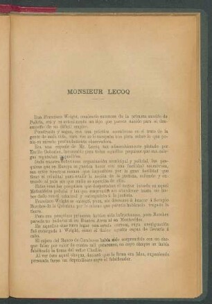
Monsieur Lecoq

Lecoq, Henri
Lecoq, Louis Daniel
LeCoq Turkestan
LeCoq Turkestan
Lecoq, Gustav v.
Territorialkarte Russisches Reich
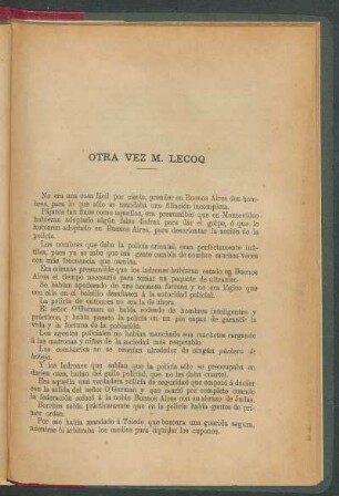
Otra vez M. Lecoq
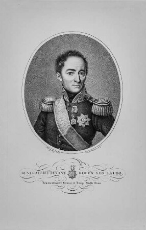
Generallieutenant Edler von Lecoq
Die Schauspielpädagogik Jacques Lecoqs
Lecoq
Lecoq
Monsieur Lecoq
Lecoq, Henri
Lecoq, Louis Daniel
LeCoq Turkestan
LeCoq Turkestan
Lecoq, Gustav v.
Territorialkarte Russisches Reich
Otra vez M. Lecoq
Generallieutenant Edler von Lecoq
Die Schauspielpädagogik Jacques Lecoqs
Lecoq
Lecoq
Monsieur Lecoq
Lecoq, Henri
Lecoq, Louis Daniel
LeCoq Turkestan
LeCoq Turkestan
Lecoq, Gustav v.
Territorialkarte Russisches Reich
Otra vez M. Lecoq
Generallieutenant Edler von Lecoq